Affinity Photo 1.5 sneak peek. A new HDR persona.
https://vimeo.com/175371036
Not long ago we wrote a post about the upcoming Affinity Designer 1.5, this month we will be looking at the anticipated Affinity Photo 1.5 that is due towards the end of September 2016. We can expect some really exciting new features such as dedicated HDR support and a HDR persona which will really add some power when editing HDR image stacks or even single jpg images as in the demonstration above.
Also is the introduction of 360 degrees images and the seamless editing of them.
Affinity Photo 1.5 is expected to include the following:
- Advanced HDR merge producing full 32-bit linear colour space images
- An entirely new workspace for tone mapping
- Focus stacking to bring depth to multiple combined images
- Batch processing for smoother, faster workflow
- Macros to record and replay a set of commands
- An all-new way to edit 360 degree images
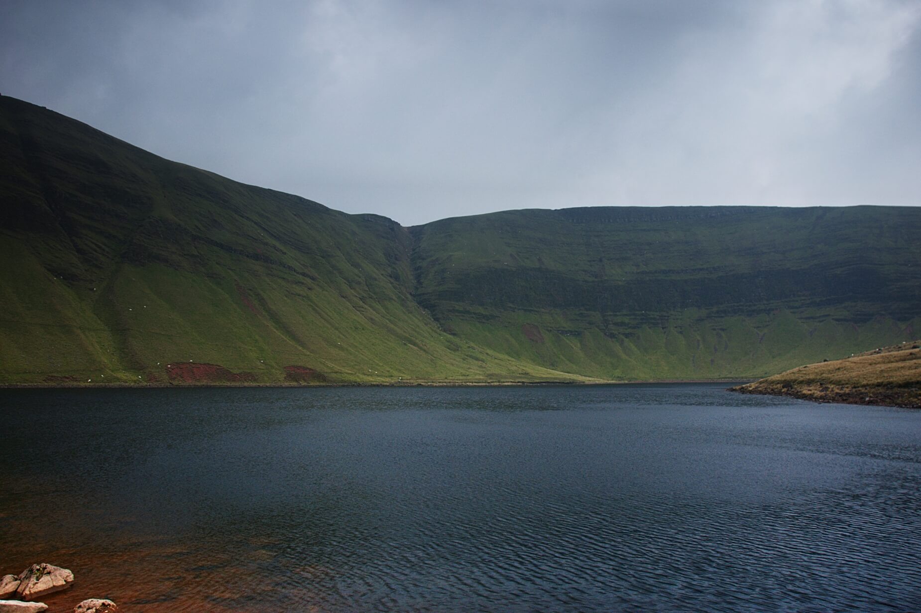
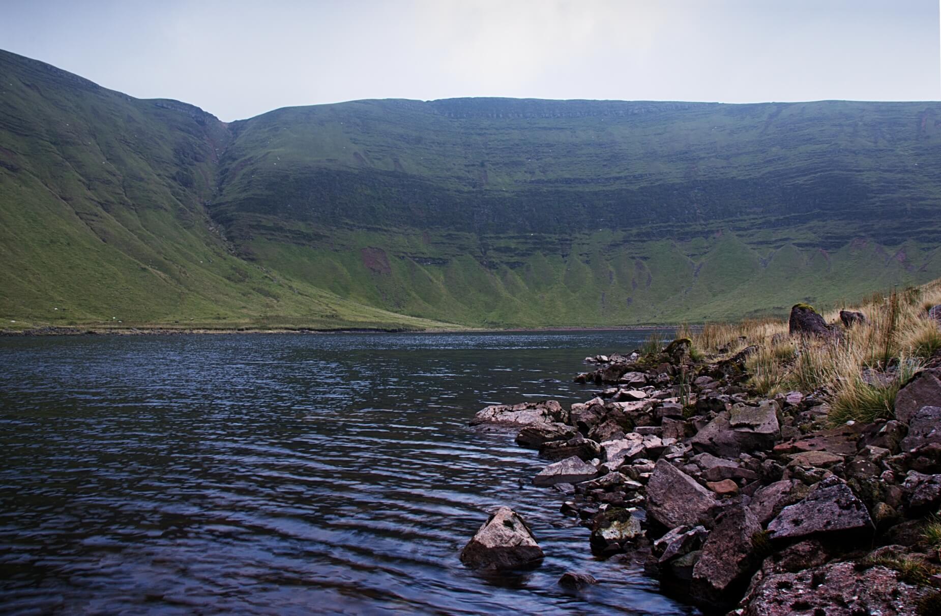
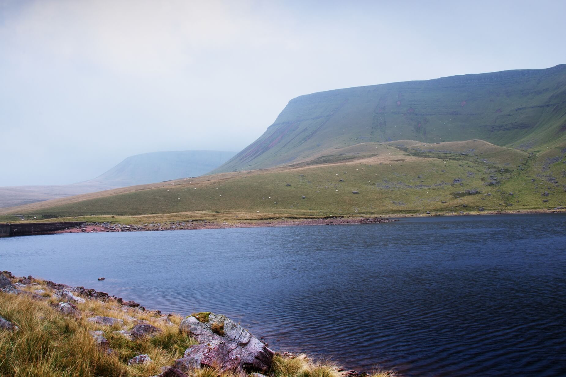
Llyn y Fan Fach, Brecon Beacons. Photography and walk.
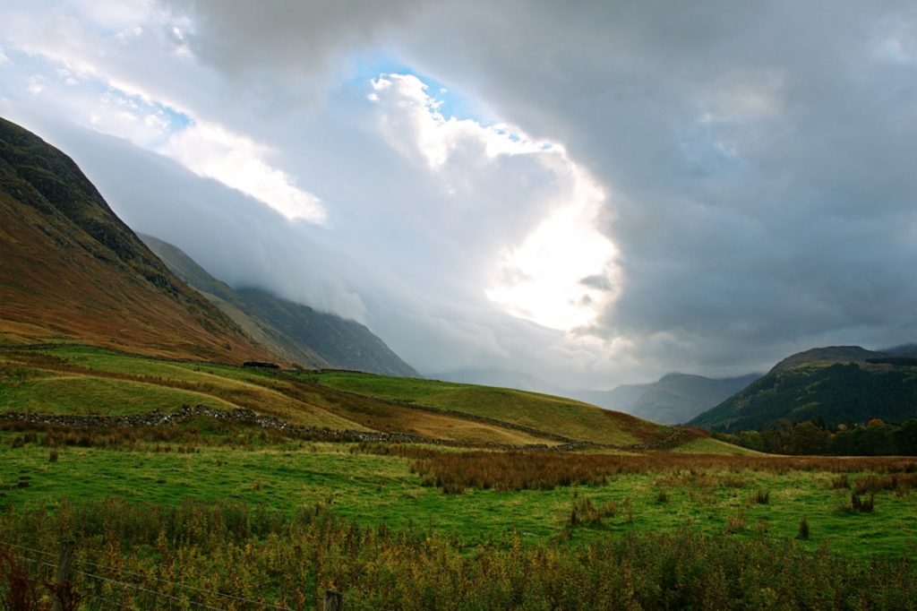
Right in the middle of the west Brecon Beacons National Park is a mystical lake, high up in the mountains, the Llyn y Fan Fach lake sits at the foot of the Black Mountain. Even without the folk tales the lake has a sense of eery silence to it, almost entirely surrounded by ridges the lake is quiet and still with shadows cast over parts of it.
Llyn y Fan Fach has its very own folktales that add to the magical sense of the place, it's definitely worth reading about before you go. Here is a short narration of the tale.
https://www.youtube.com/watch?v=0Sub71snnUE
Llyn y Fan Fach Circular Walk
Llyn y Fan Fach is a great place to go for a short walk with some incredible scenery that you will struggle to find anywhere else, the atmosphere around the lake is just incredible and well worth a visit anytime of the year.
Getting there
Getting to Llyn y Fan Fach is pretty simple but the roads are country lanes at best, I certainly wouldn't advise coming during bad weather unless you have a decent 4x4 and even then you will struggle to get out in the snow. Around summertime you can access the carpark easily after driving down a few gravel lanes, which have been improved recently, it's a bumpy ride but an enjoyable one.
The walk is around 5 miles in total but can be longer depending on where you come back down the ridge. I've mapped out the route I took although I definitely missed something somewhere as I ended up coming down a small but steep gully, a path I certainly wouldn't recommend to most.
In general it's a very easy going route with most uphill parts being pretty gradual, the walk along the ridge is spectacular and follows all the way to distinctive escarpment of the Black Mountain.
Depending on your fitness you can complete the walk within a few hours but keep an eye on the weather either way. From the car park you can follow the gravel track all the way up, past the fish farm and all the way to the Llyn y Fan Fach lake. From the the lake you can easily see the path right of the lake following up along the ridge. This might not be as obvious in mist or cloud so it goes without saying, take a map and compass.
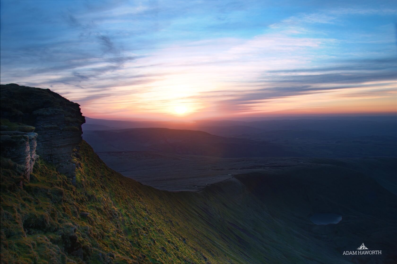
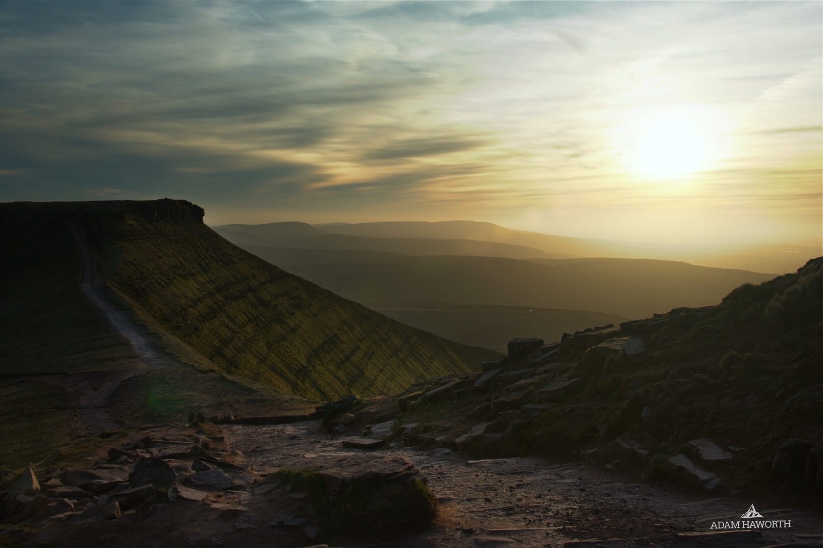
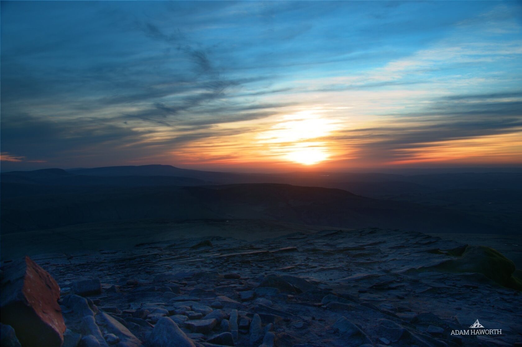
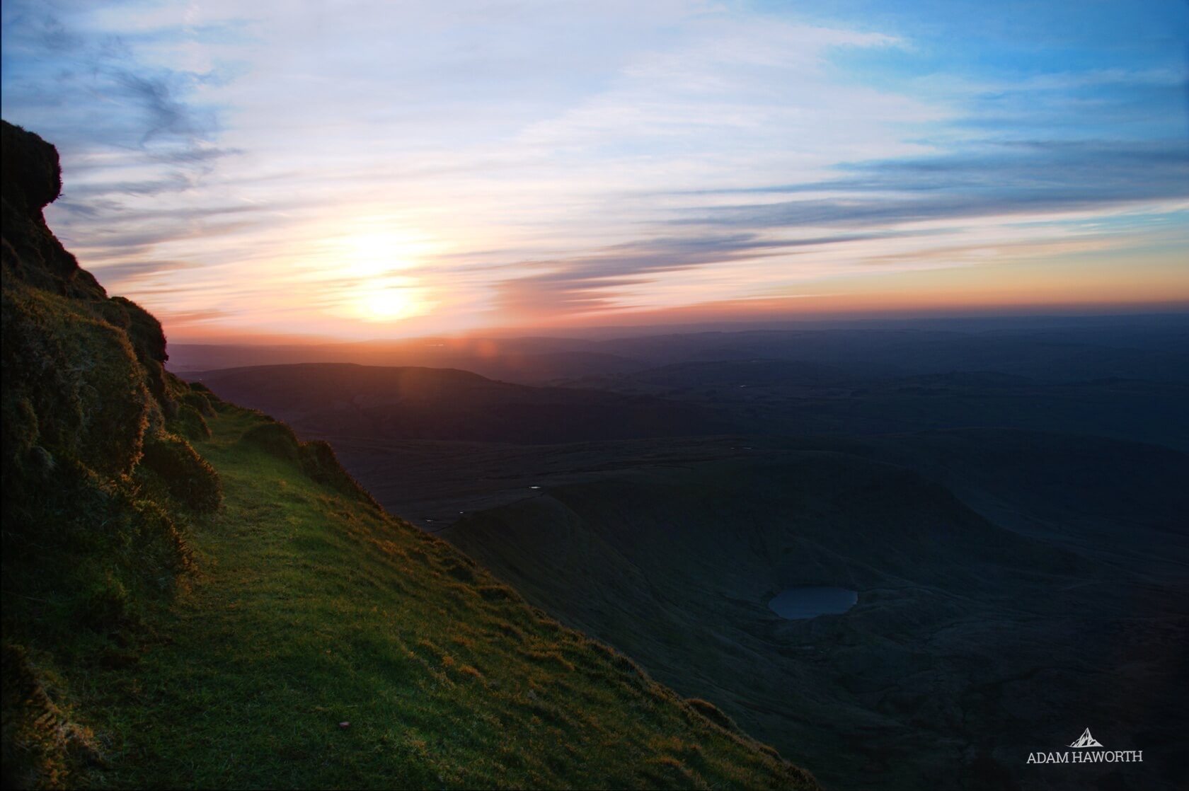
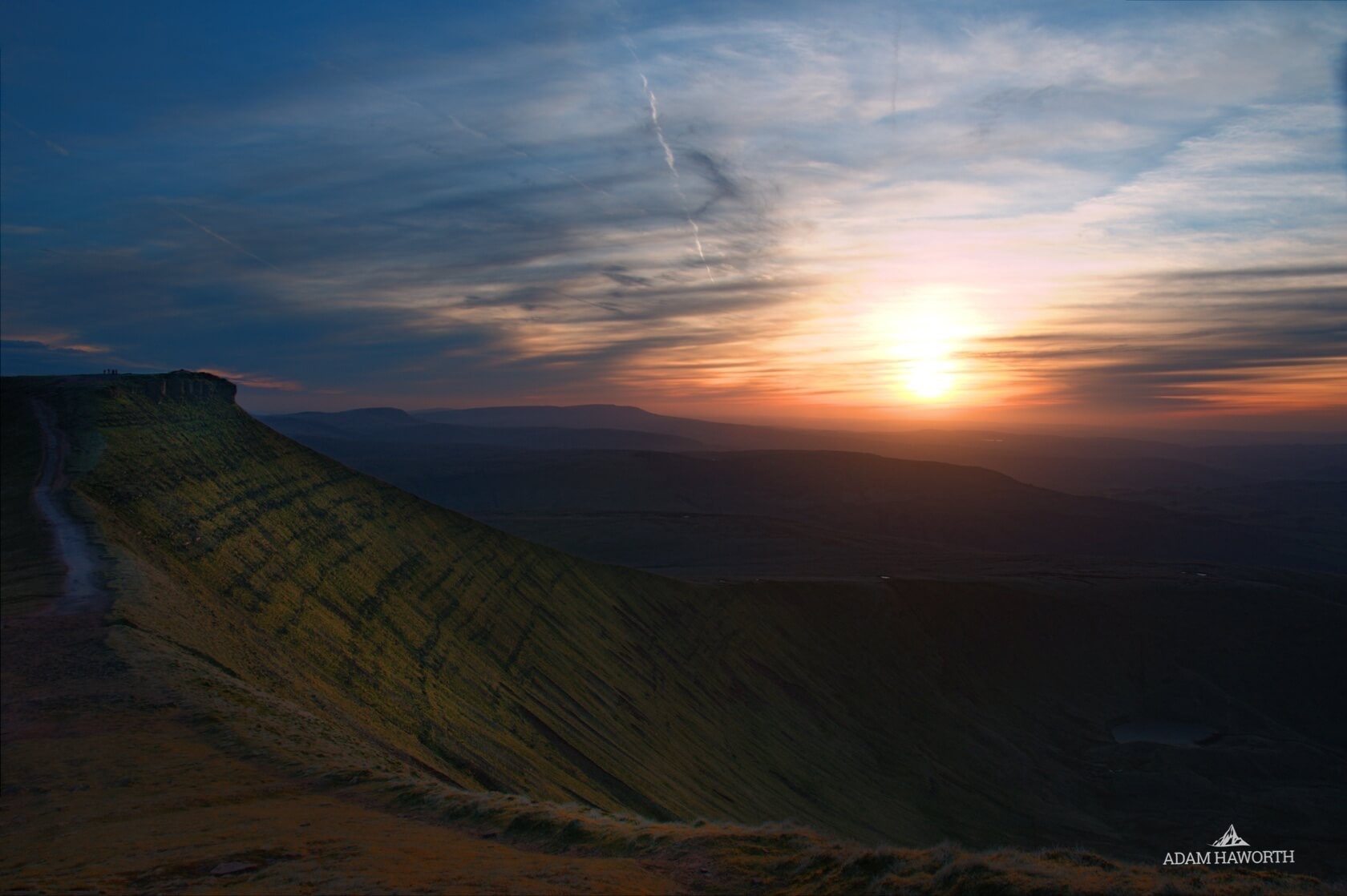
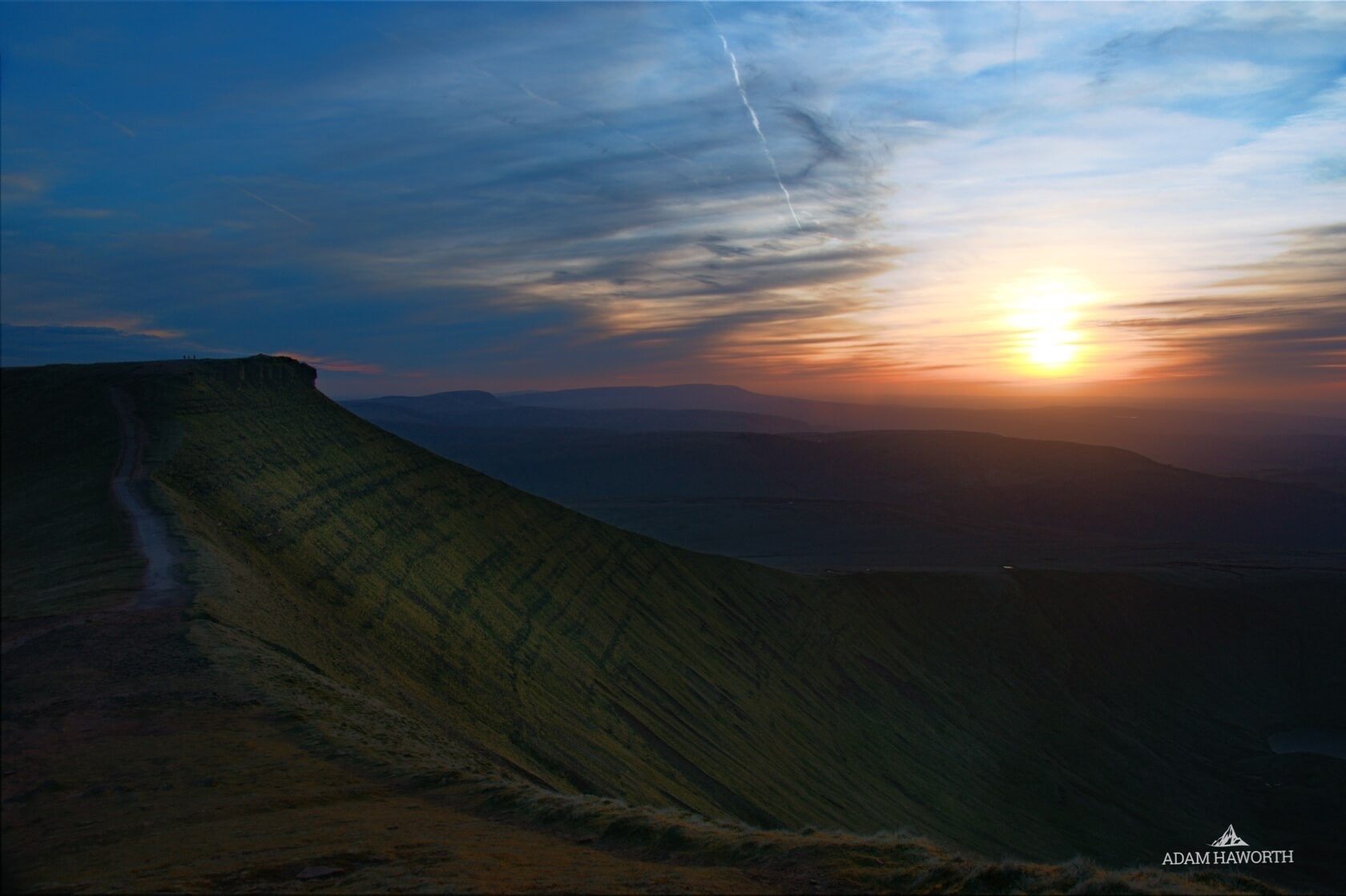
Sunset on Pen y Fan, Brecon Beacons
It's been awhile since I've managed to get some good pictures while on the Brecon Beacons. I've put the odd one on Instagram but apart from not having the opportunity to get on the hills as much as I'd like, there just haven't been many pictures presenting themselves.
"The best times to be sat on top of a mountain are always the most challenging times, as the sun sets or as it rises."
Wednesday Afternoon I set off to Brecon to try and capture the sunset from the top of Pen y Fan, I left Hereford around 5pm and managed to make it to the Storey Arms car park by 6:15pm. I wanted to get straight up and check out different locations before the sunset at 8pm so I thought the route straight up from Storey Arms would be the best option.
I ended up sitting around the top of Pen y Fan for about an hour before the sun started to set, not a bad place to enjoy the view for an hour but my fingers started to get cold after a while. It was an incredible day, temperature setting off was around 16˚ and around 8˚ on the top. The wait was well worth it, these are a bunch of pictures I picked out and edited. Leave your comments below.

Our gift to you: Free Photo Bundle
We decided to thank our readers and visitors to the Lakewood site by giving away some of our photography each month. Over the years we have accumulated a vast collection of stock photography, not all of it gets utilised or even seen so we thought it would be a great gift to everyone and an opportunity for some of our photography to get put to good use.
All the images are taken by Lakewood director and budding photographer Adam Haworth. Feel free to use the images for your own project, as a desktop background, on marketing material, in fact we are happy for you to use these images however you see fit.
Here are April's free images, please scroll down to view the download link for the high res originals.
Click here to download the images
Please note the following terms:
Subject to the terms of this License Agreement, Lakewood grants Licensee a perpetual, worldwide, non-transferable, non-sublicensable, non-exclusive right to reproduce, transmit and display, in whole or in part, the Images and right to create derivative works (collectively “use”) with respect to the Images identified on in the link above, for up to 500,000 print copies and up to 1,000,000 impressions for digital copies, under a standard license, for all uses in all media. As part of the standard license, Licensee may alter, crop, modify or adapt the Images. Licensee may make a copy of the content for internal back-up purposes provided Lakewood's copyright management information and any Image identifying information embedded with the digital file (“metadata”) is retained with the file. Limited, temporary transfers of the Images are permitted to third parties integral to the creation of the final product, provided such third parties agree to abide by the terms of this Agreement.
Ownership of Derivative Works.
In the event that Licensee creates a derivative work based on or incorporating one or more Images, all rights in and to such Images shall continue to be owned by Lakewood or its Contributor named above, subject to Licensee’s rights to use such Image(s) pursuant to the terms of this Agreement.
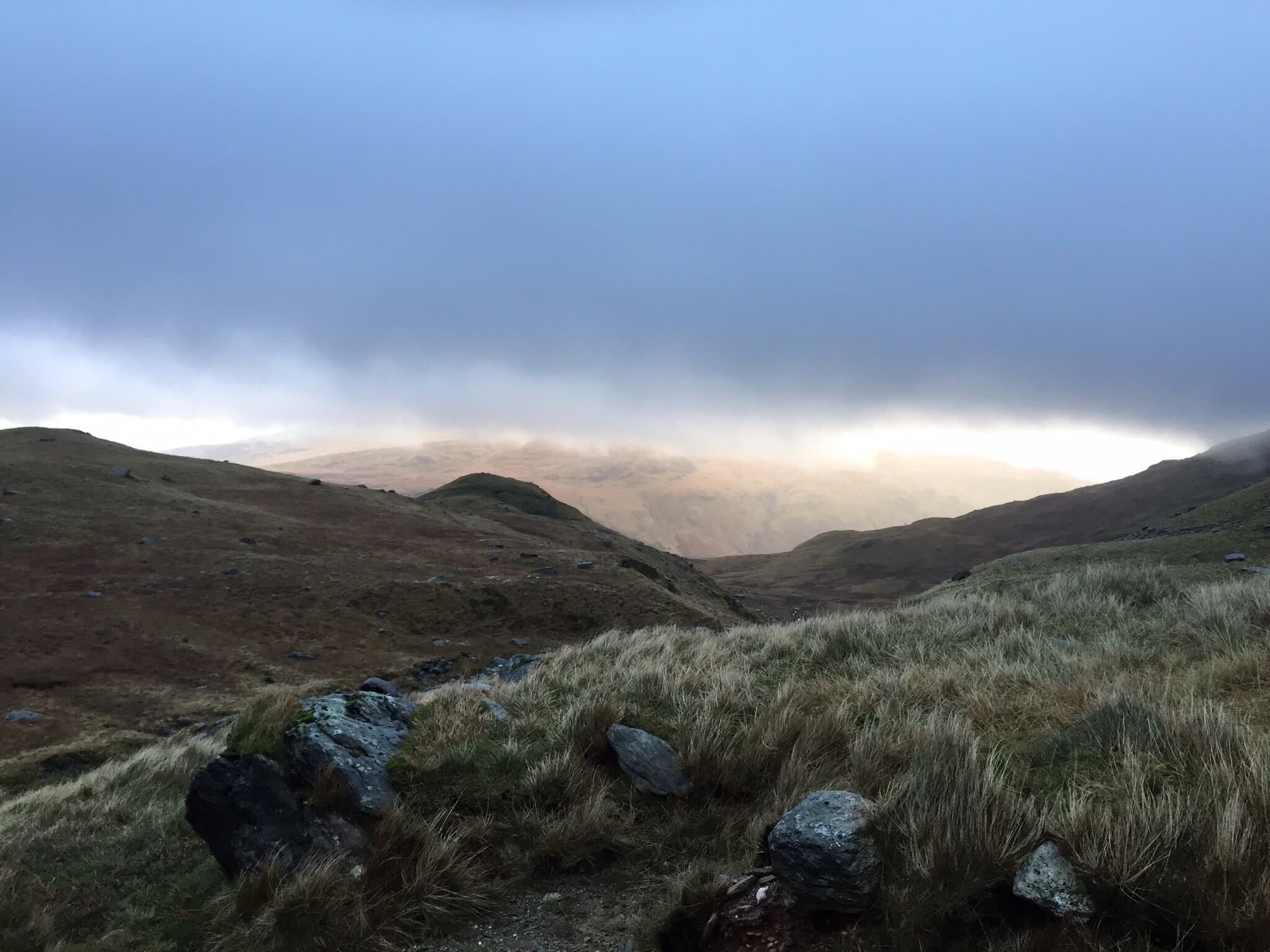
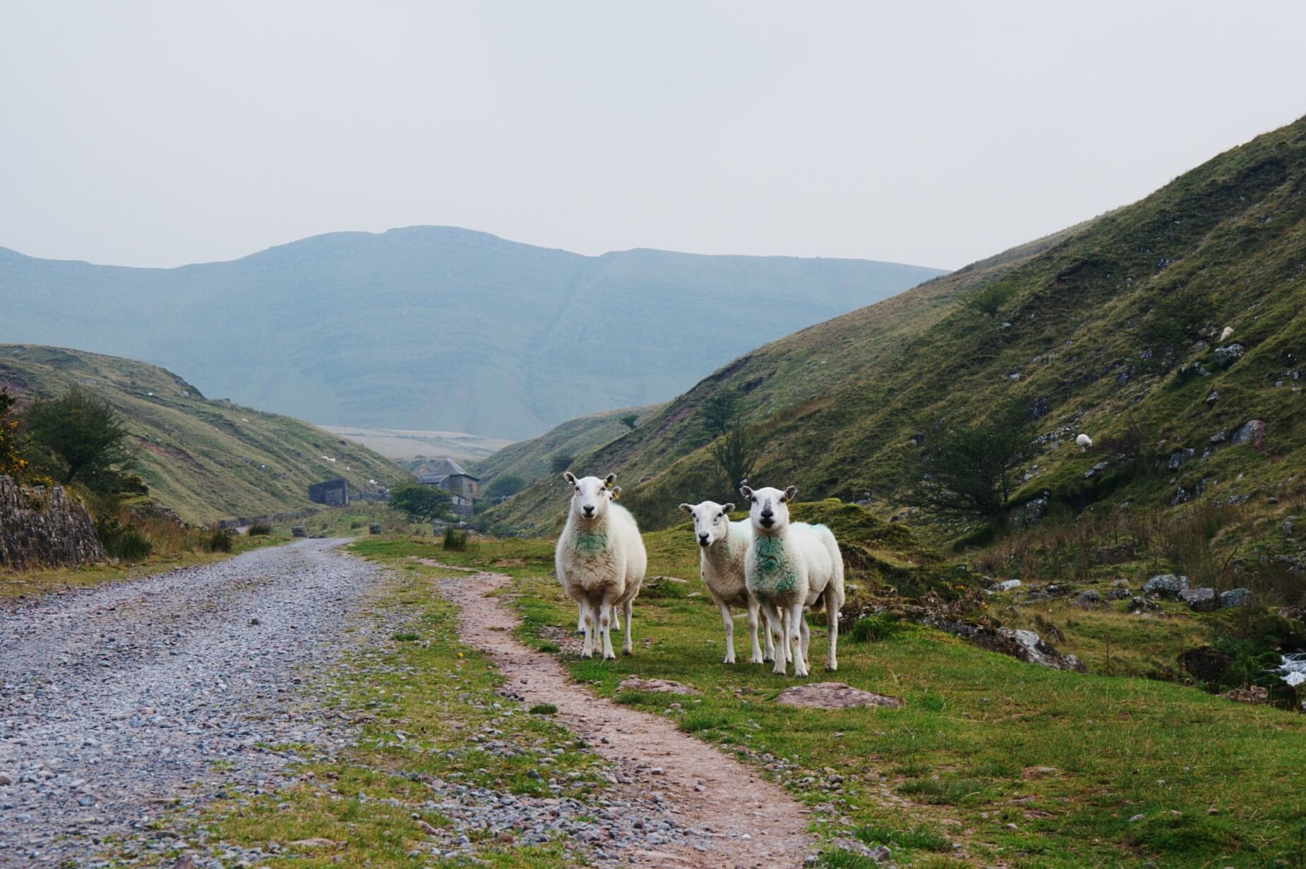
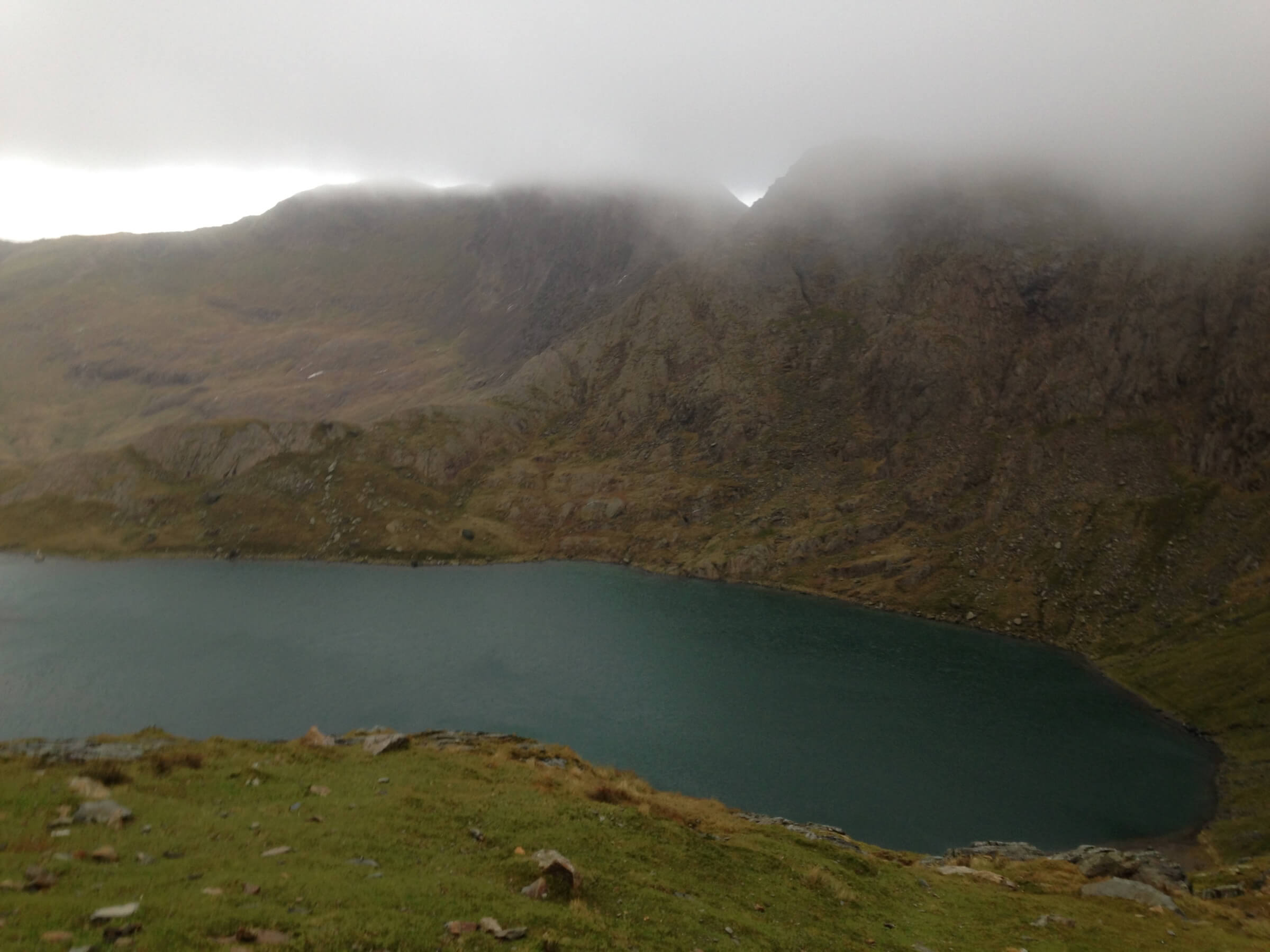
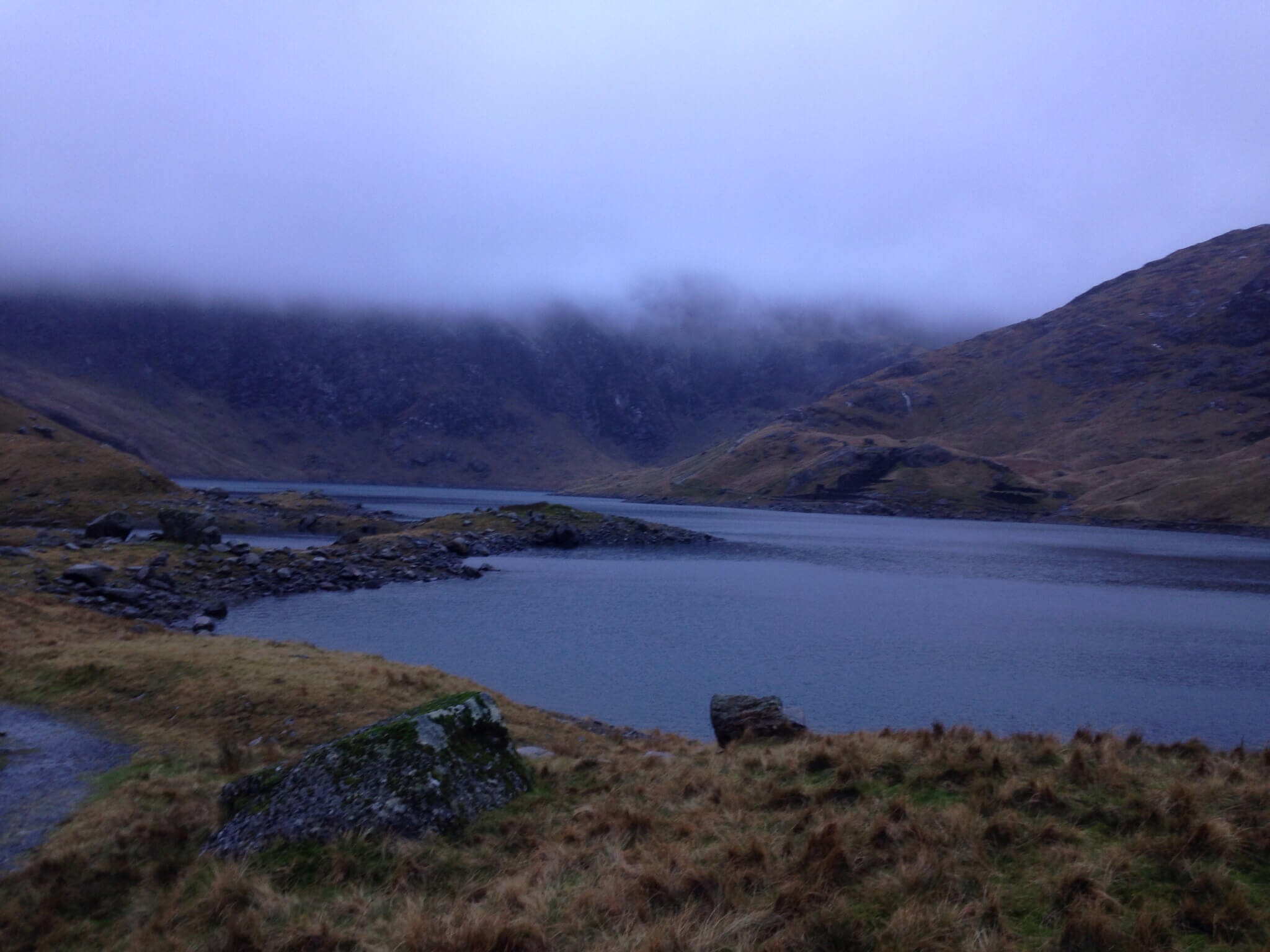
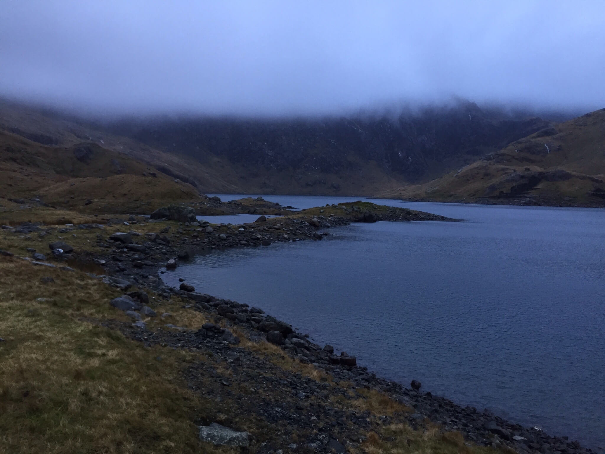
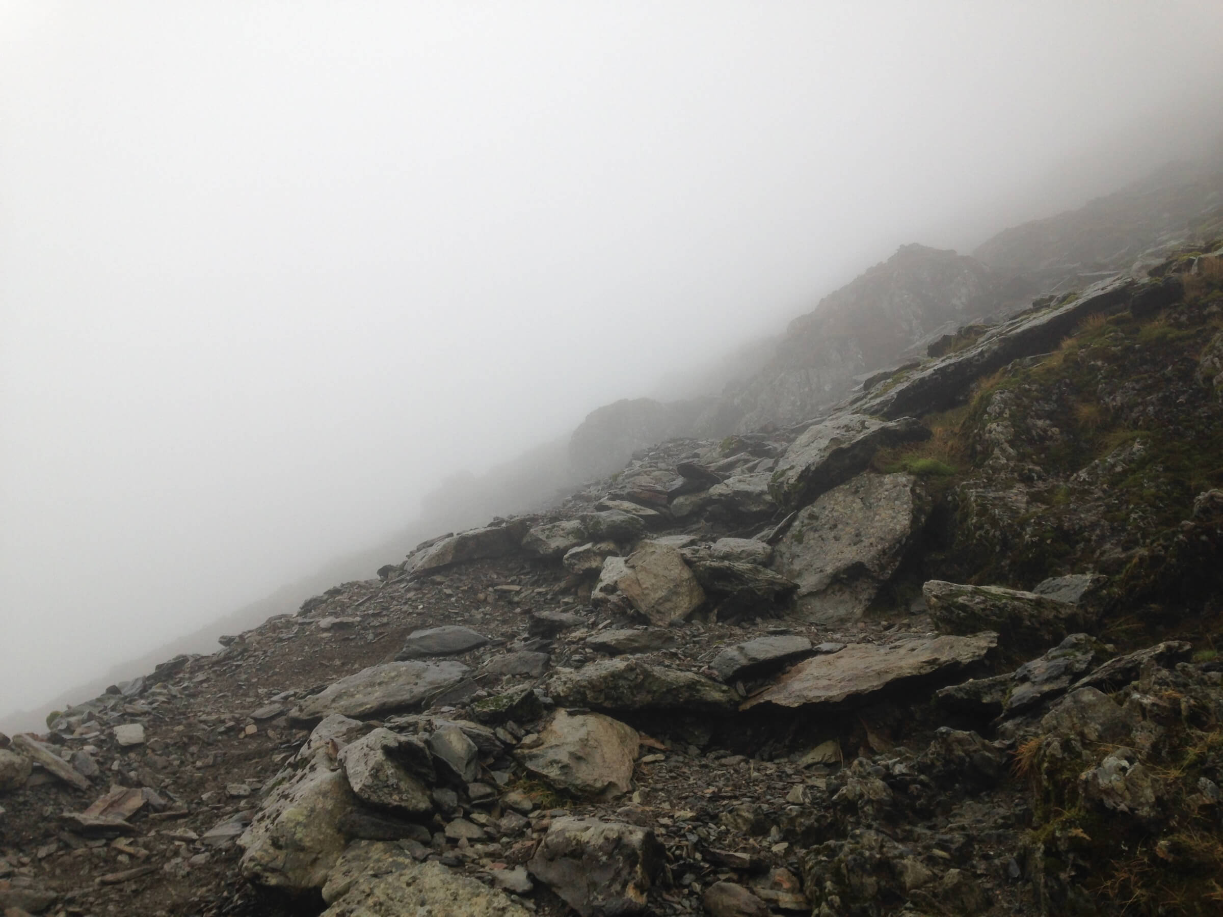
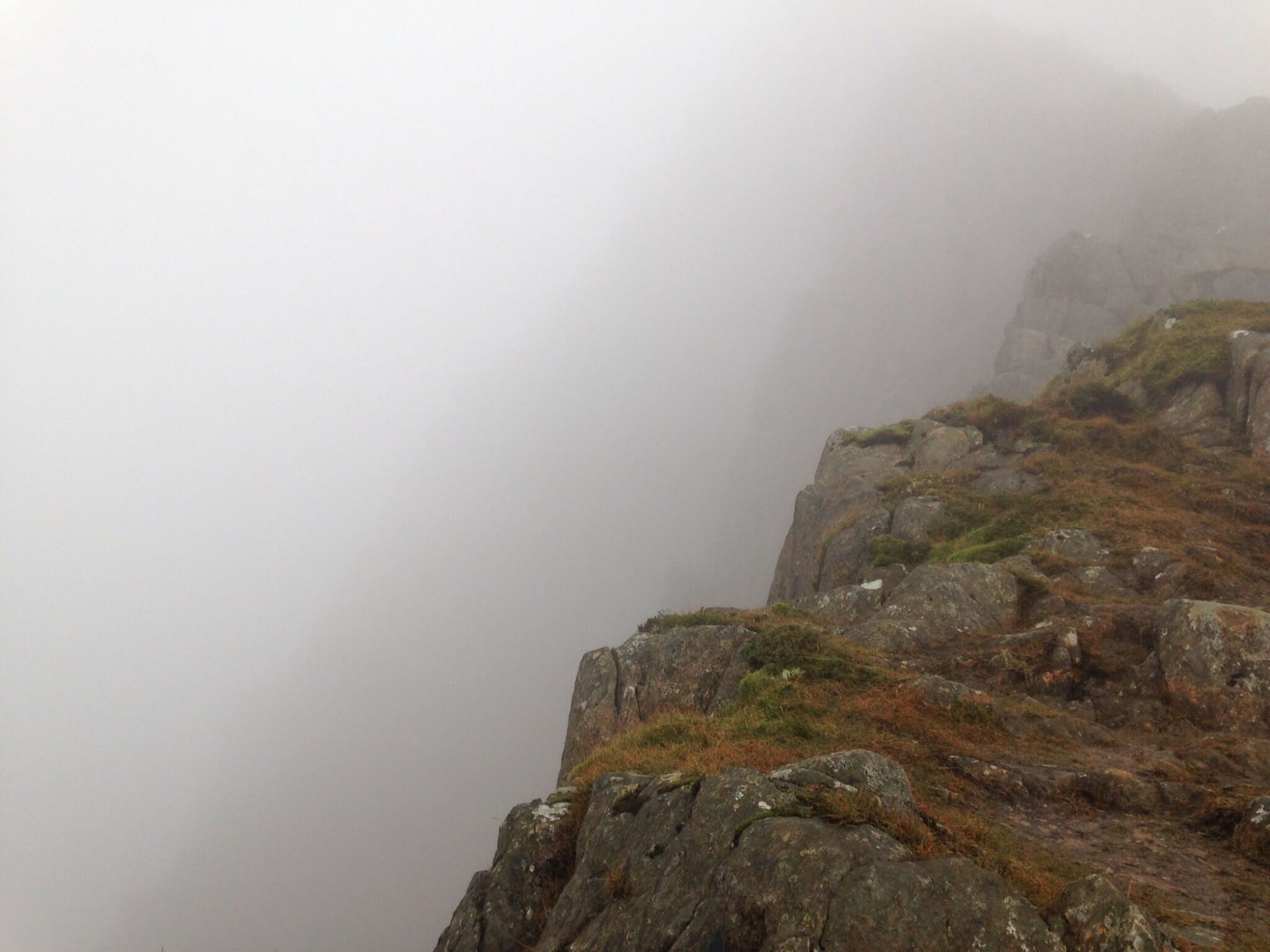
Snowdon, Y Lliwedd and Pyg Track Routes
Earlier in January I took a short break in North Wales and went up Snowdon.
Last time I went up Snowdon was 2014 in August and it was a little underwhelming from what I remember, apart from the congestion on the tourist Miner route the whole thing was a little too easy going. It left me wanting to go back and try a more challenging route and visit in winter when it will be more interesting with less people about. My initial plan was to go via the Crib Goch route but decided against it as there were a few of us in the group that weren't that experienced or confident with scrambling, although there was no snow what so ever there was always a chance of some in winter.
After going through a few different routes I figured the best would be the Y Lliwedd route up and the Pyg Track down, in total it would work out surprisingly short at just under 8 miles in total. I mapped the route below, if anyone knows a better way of doing this please let me know in the comments. I can't remember the name of the OS system that I used to use.
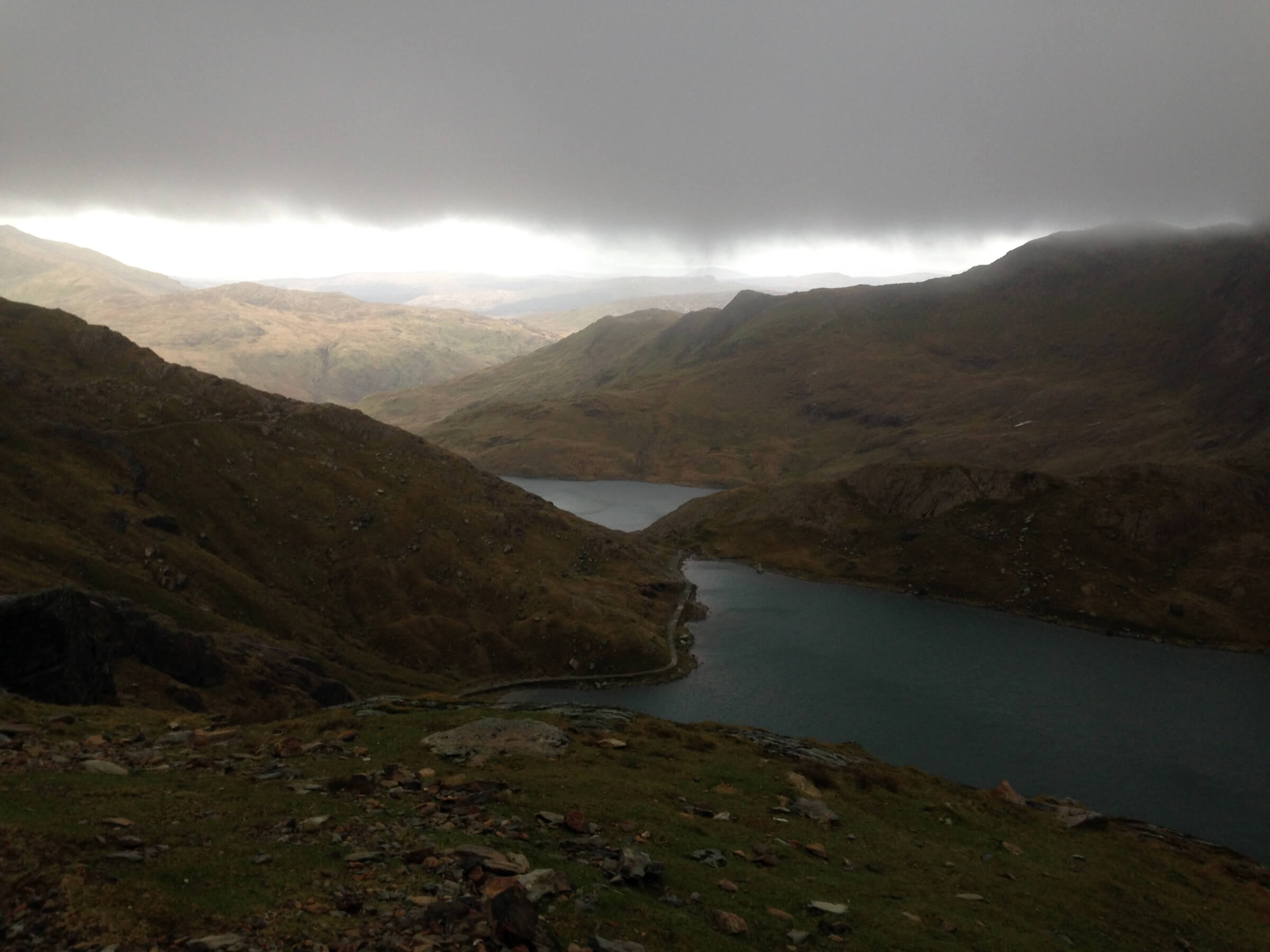
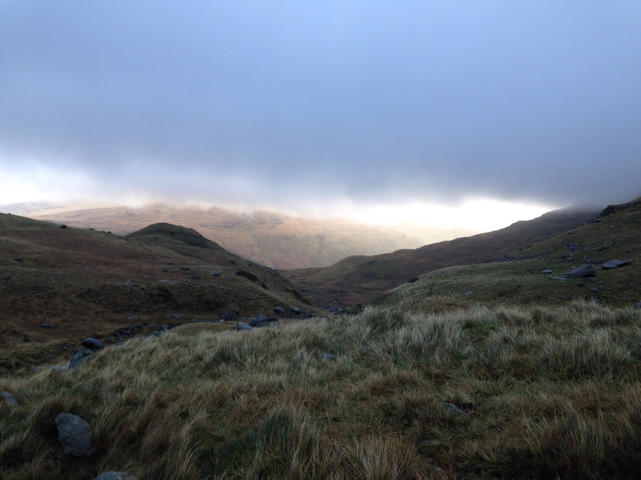
We set off early Tuesday morning from the Pen y Pass car park, the rain was persistent until about 10am. From the car park just head down the Miners path and follow until you get to the first lake and then take the path to the left. When on the ridge you can easily loose the path but just stay close to the ridge and keep following it, the visibility was terrible on the day we went and we lost the path on one occasion but soon found it again. You will eventually get to the junction and join into the Watkins Path, from here is pretty straight forward to the summit with a tricky climb up the shale but once you cover the shale climb you have got past the hardest parts and its all easy going from there.
We decided to come down the Pyg Track as light was getting low, its all easy going down from here especially after coming up the Watkins Path. Pictures aren't that great as nothing really presented itself and the rain kept the camera in the dry bag the entire time.
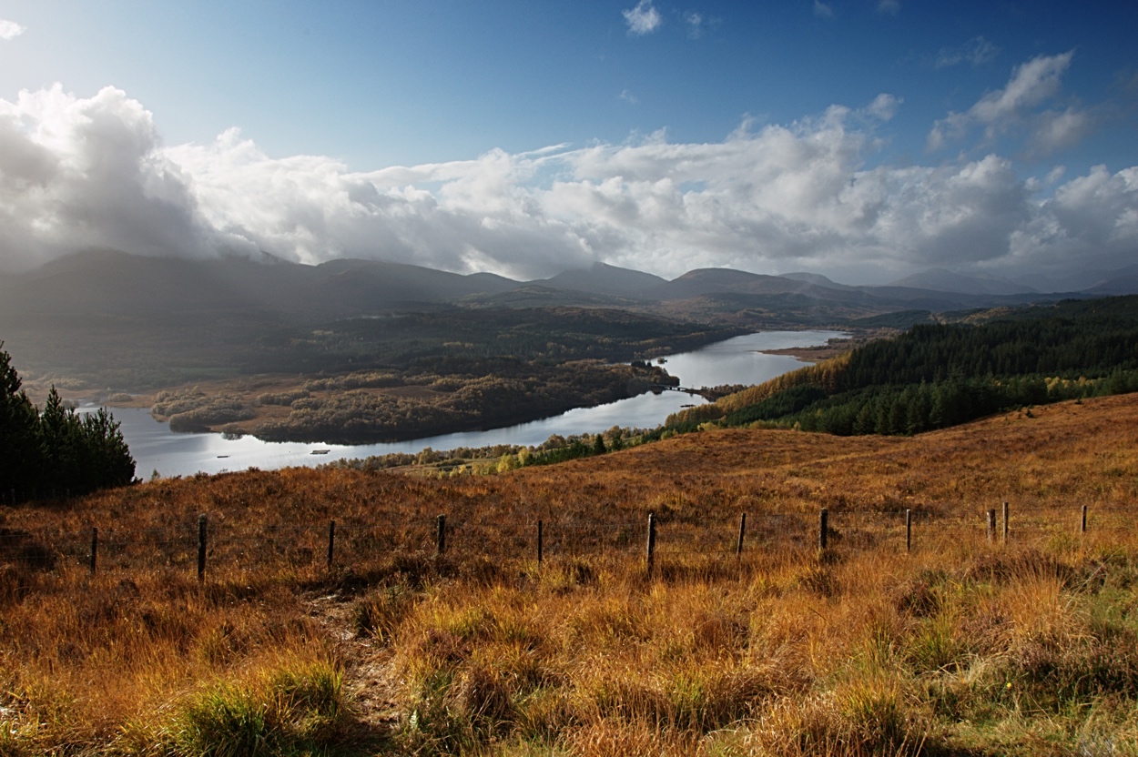
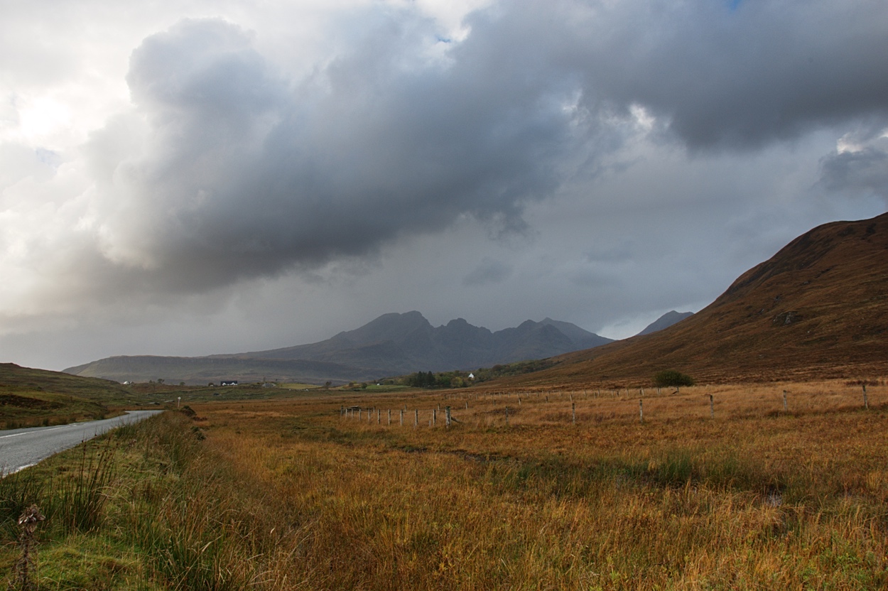
Isle Of Skye, Scotland. Part Of Ben Nevis Trip
Carrying on from the Ben Nevis during my Scottish trip I planned to travel up to the Isle Of Skye, it is a place that I've wanted to visit for quite some time. After a couple of days in Fort William and a successful hike up Ben Nevis we set off on the short trip from Fort William to the Isle Of Skye.
"The ferry was shut due to the winds so we drove from Fort William via Invergarry, after a few days of constant rain the day we went to the Isle Of Skye was incredible the sky just cleared and the scenery was fantastic."
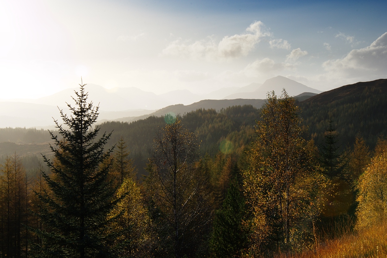
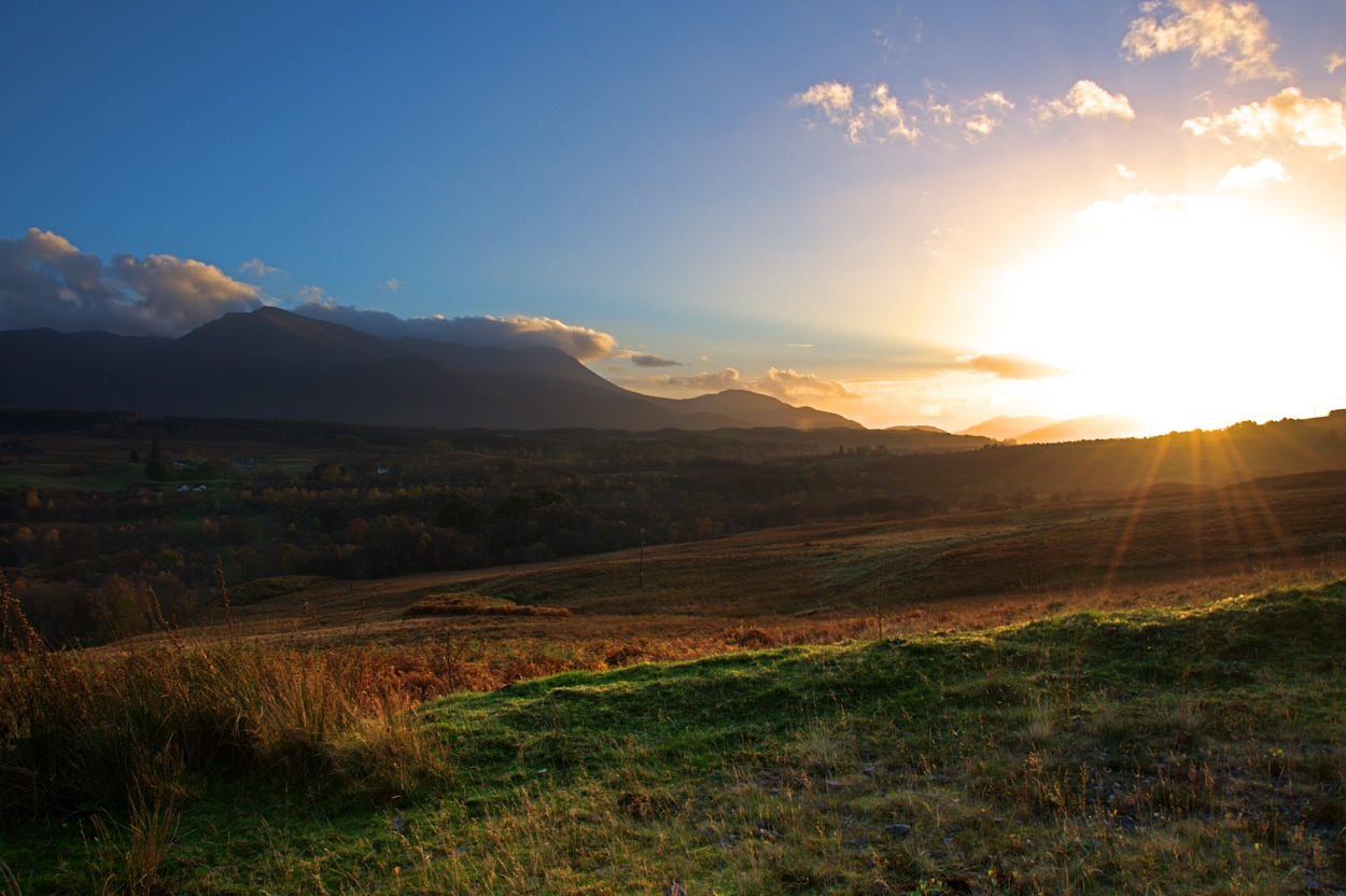

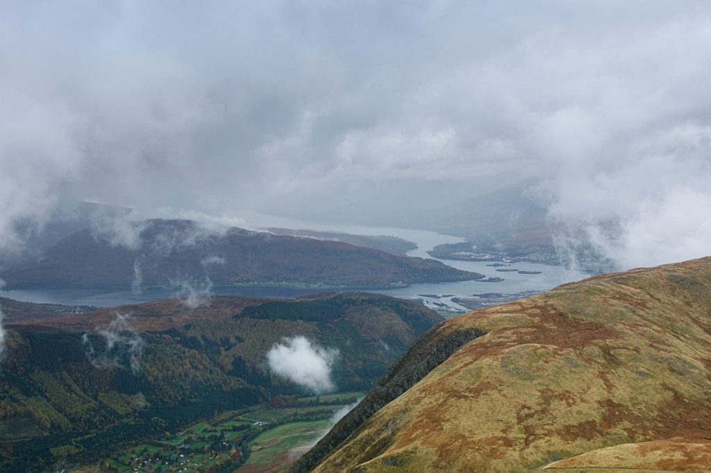
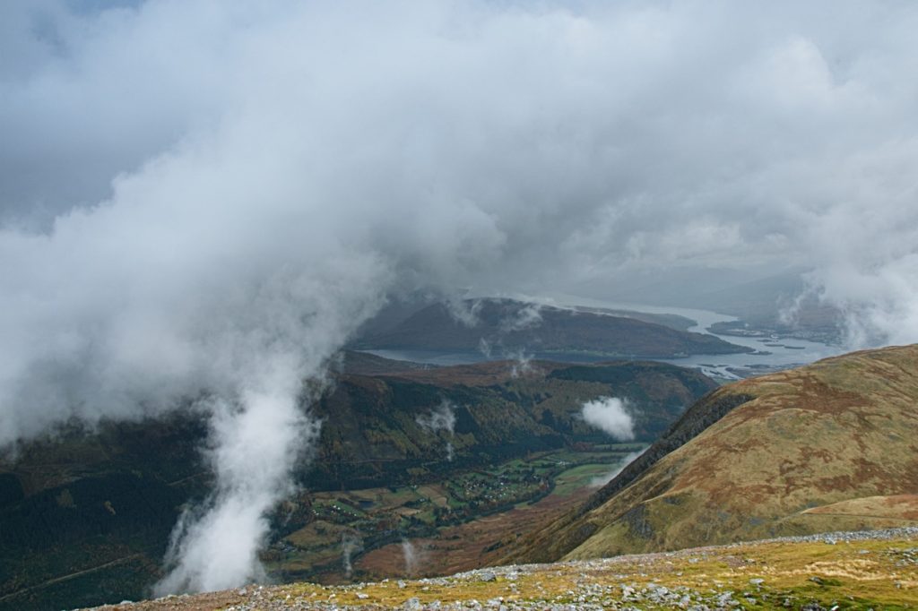
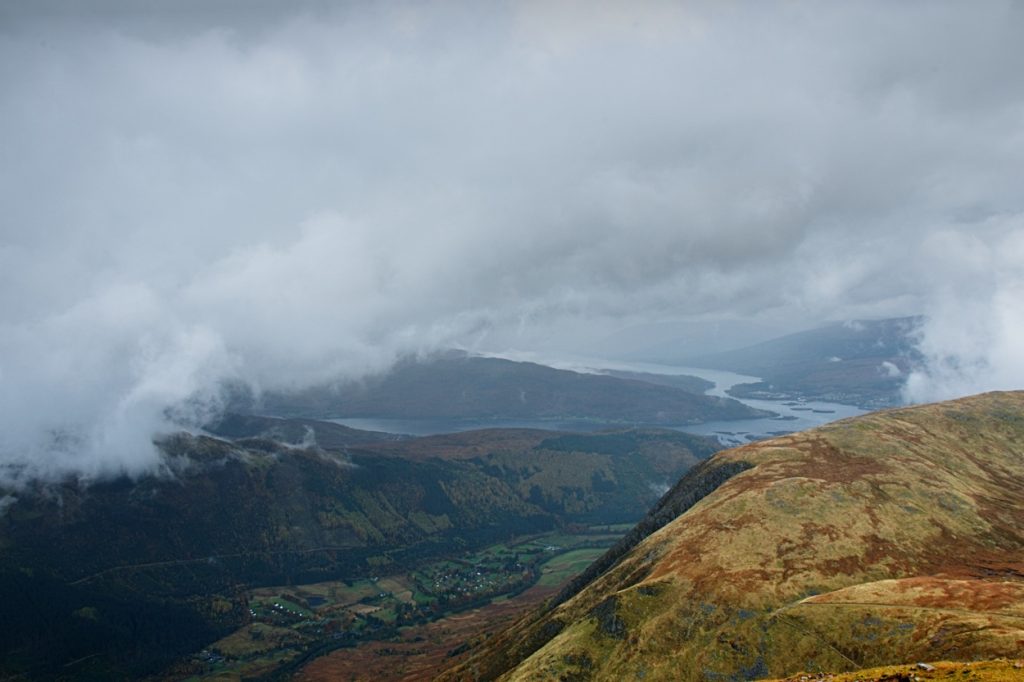
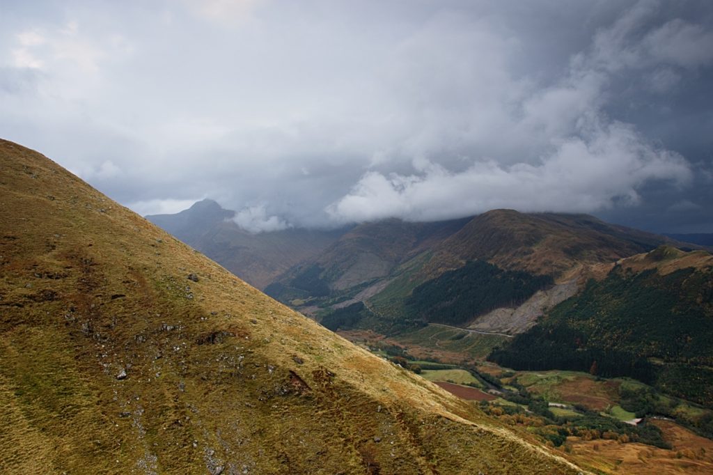
Ben Nevis in Autumn
Ben Nevis has been on my list of places to go for the last year, it would be the last of the three peaks in the UK to summit after going up Scafell Pike in February and Snowdon in 2014. I set a date to go up to Scotland at the end of October for 4 days. I set off from Herefordshire Monday night into a 9 hour drive to Fort William, stopping at Lancaster for the night and continuing the journey first thing in the morning. We made it to Fort William in the afternoon, a little later than expected due to a stop in Glasgow. Driving from Glasgow along Loch Lomond is just spectacular, striking a reminder of the Pyrenees as we drove deeper into the mountains. We arrived at our hotel, the Clan McDuff, just as the sun was setting across the Loch Eil, what a spectacular view.
Our plan was to head towards Ben Nevis first thing the day after we arrived, we got up around 6am to check our bags and drive a few miles to the North Face car park to head up the mountain via the Carn Mor Dearg Arete (CMD Arete) route. The weather was terrible from the moment we made it to the car park, it rained constantly but it was incredibly warm around 14°-15° centigrade all morning. After making a stupid error with our navigation we ended up walking 4 miles off track, by the time we corrected our path we decided it was going to leave us short on day light to carry on with the planned CMD Arete route so we headed to the Glen Nevis mountain path.
We made it to the summit around 3pm, later than expected but even with the set back it still gave us enough time to make it down before it got dark. The weather never really improved much and although at one point we were the highest people in the UK we couldn't se a bloody thing.
Below are some pictures taken on the trip up Ben Nevis. Later I will be posting about my trip to the Isle Of Sky.


Brecon Beacons, Peaks & Waterfalls Circular Walk
I’m sure I wont be the only one to say I miss the hazy summer rides and dusty woodland trails on a Saturday afternoon; there is a real easiness to life when you don’t have to worry about forgetting your bike lights and packing extra layers... Wait, easy isn’t fun. Winter is fun! I confess I hardly touched my bike all winter, that said I wont been sitting around indoors all day if that’s what you are thinking (apart from when I was writing this and... okay, I did a little).

This trip is all about the Brecon Beacons. ‘Pen y Fan,’ I hear you thinking. Yep, we will visit the high ridges but the real beauty of this trip is on the ridgeline and lower peaks leading up to Corn Du and Pen y Fan. Best place to start this walk is from the Torpantau car park (key these coordinates into google maps 51.847776, -3.372140). From here you can start the ascent on the small footpath to the left of the waterfall; you will see this as you drive into the car park. This car park can get very busy on weekends and is used frequently by the military so take care on the way in. I say this is the best place to start as the route is very obvious from the carpark all the way to the top of Craig y Fan Ddu, just follow the steep cobble path to the top. Once near the top the path goes around the back of the peak and you simply walk along the ridge for about 1 mile. You will come to a stream that you can either pass by going through or find the footpath that leads to the east which cuts part of the walk out.
Regardless of which way you take at the stream you will eventually come to Fan y Big. When approaching from the south it looks nothing more than a hill with Cribyn and Pen y Fan dominating the background. However once at the peak of Fan y Big you can get the classic picture on the diving board rock, the drop on the other side isn’t as vertical as pictures portray but nethertheless you really wouldn’t want to fall here so take care.

From Fan y Big you can make your way back down to the path and follow the ridgeline towards Cribyn. This part of the walk can get busy depending on the weather and time of week, however there is plenty of room on top of Pen y Fan for some pictures and a deserved half way break knowing it’s all literally downhill from there.

From Pen y Fan you can follow the path over to the marginally smaller Corn Du and from there its north along the ridge with Neuadd reservoirs below to the north east. You need to follow this ridge for about 3 miles then descend toward Taf Fechan forest where you can pick up the path at the smaller reservoir. Follow the path through the forest until you come to a small road with a stone bridge and a car park. Depending how well you know the area you can either follow paths through the woods or just follow the road east to make it back to the Torpantau car park.

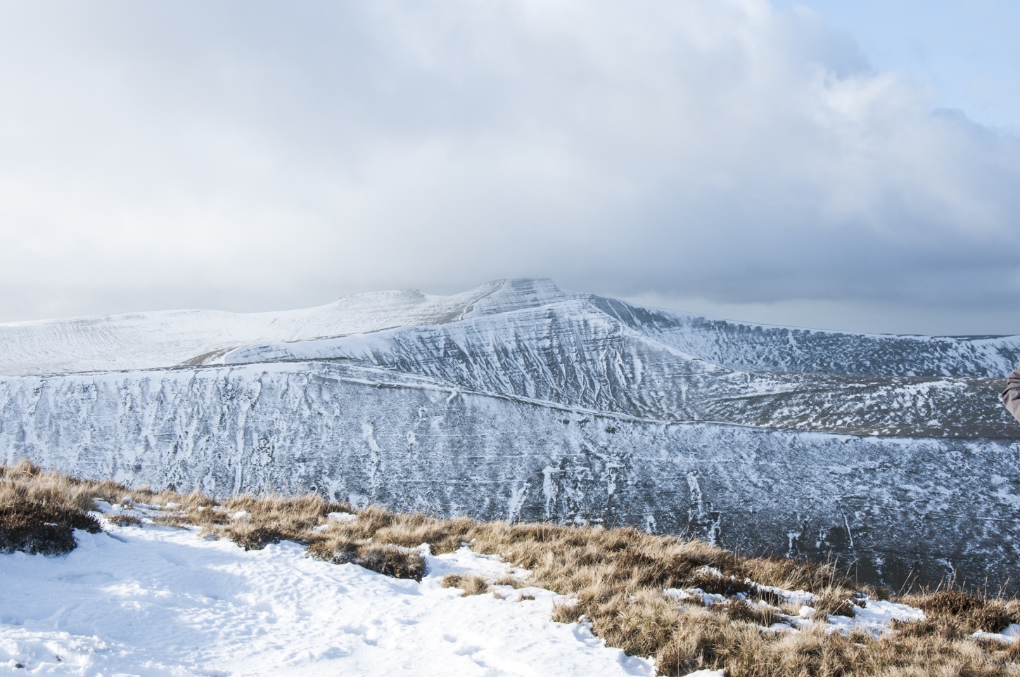
Regardless of whether you are walking or running take plenty of kit, the weather may be nice when you set off but the Beacons are notoriously unpredictable especially in this area. Snow can get pretty deep on the ridges so stick to the path if there is one.
Details
Max Height: 854m
Min Height: 402m
Total Asc: 825m
Total Desc: 825m
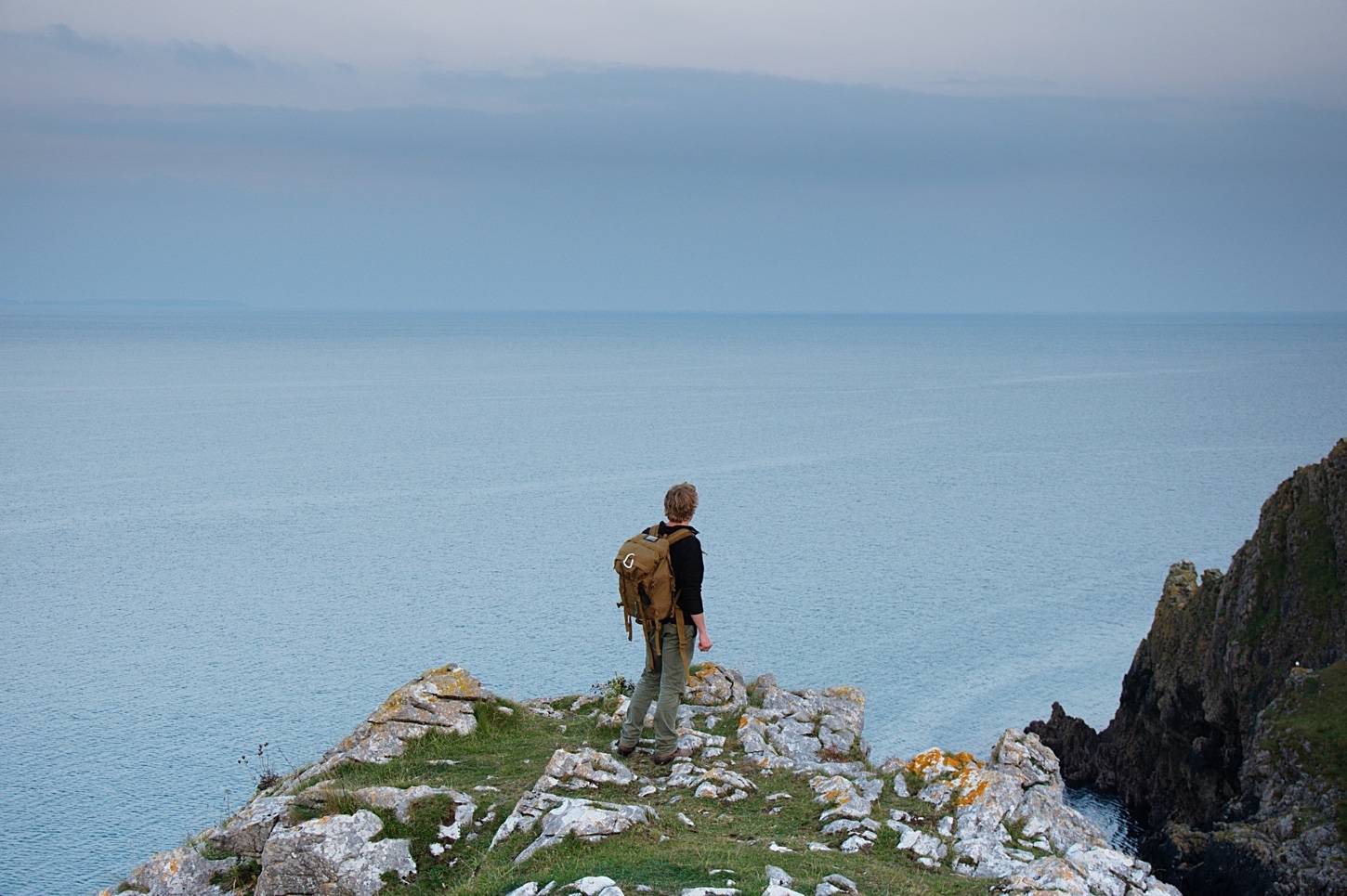
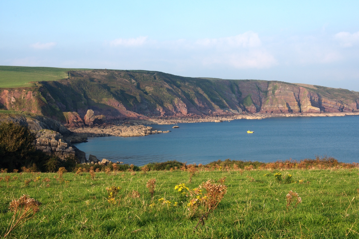
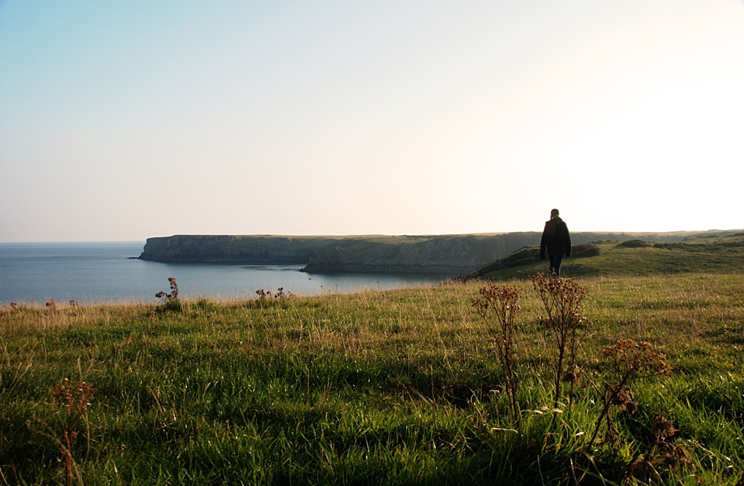
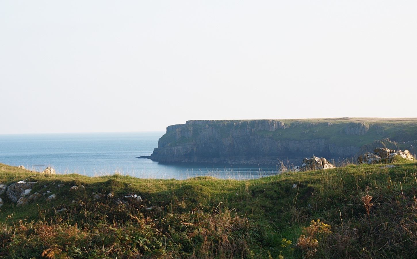
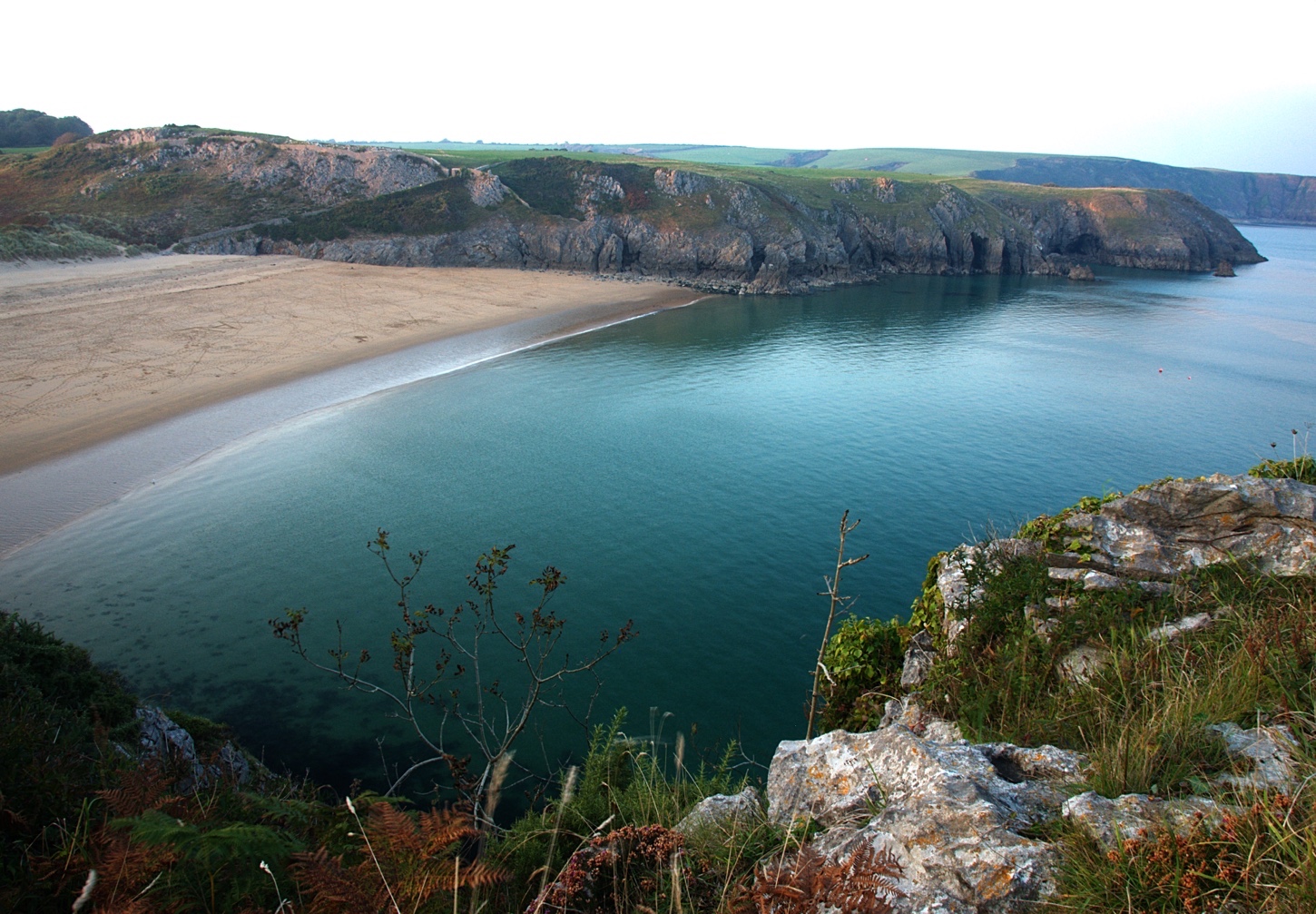
Pembrokeshire, Barafundle Bay. Britain's Best Beach?
Barafundle Bay is a National Trust beach in Pembrokeshire, Wales, you could say it is possibly one of Britain's best beaches. Getting to Barafundle Bay requires a half mile walk from the National Trust carpark, this in fact makes the beach even more magical as you walk through a small woods and emerge with a view along the beautiful Pembrokeshire coastline. As you walk along you will find it hard to believe the view will actually get better the closer you get to the Bay, but indeed it does. You reach the top of the cliff overlooking Barafundle Bay and approach an archway with a path leading to the pristine sands below.
I first visited Barafundle Bay in 2014 during summer, I brought my dog Archie who found great joy in being free to go anywhere on the beach and got to meet plenty of other happy dogs. Shortly after the trip in 2014 Archie sadly passed away, I've always wanted to go back and see Barafundle Bay as it is the last place we visited.
This year I visited in Autumn, we managed to catch a great weekend for weather and made a trip to Barafundle Bay on a Saturday afternoon. Not sure what time of year the National Trust charge for parking but I never had to pay the second time I visited.
If you are thinking of visiting Barafundle Bay check out the Visit Pembrokeshire website for more details.
Sunday at Llanthony in the Brecon Beacons
The end of summer is feeling more real the deeper we go into September, it certainly feels like summer has finished here, its almost time to get the winter gear out. I do love Autumn though, in fact it is one of my favourite seasons for photography. The colours and light make for some really deep moody pictures, and being surrounded by forest there is plenty of opportunity to create some really amazing pictures here in Herefordshire and the surrounding areas such as the Brecon Beacons.
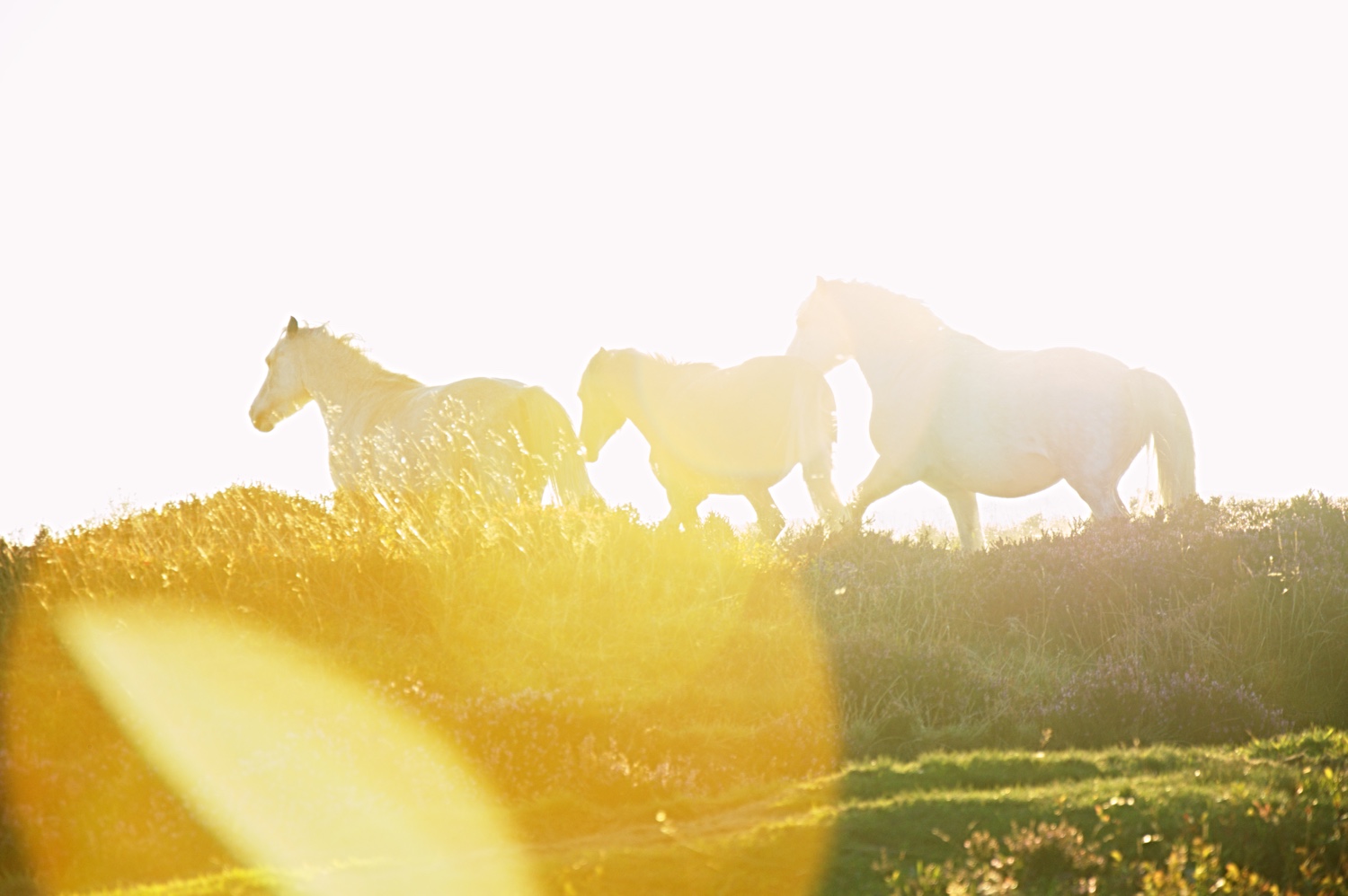
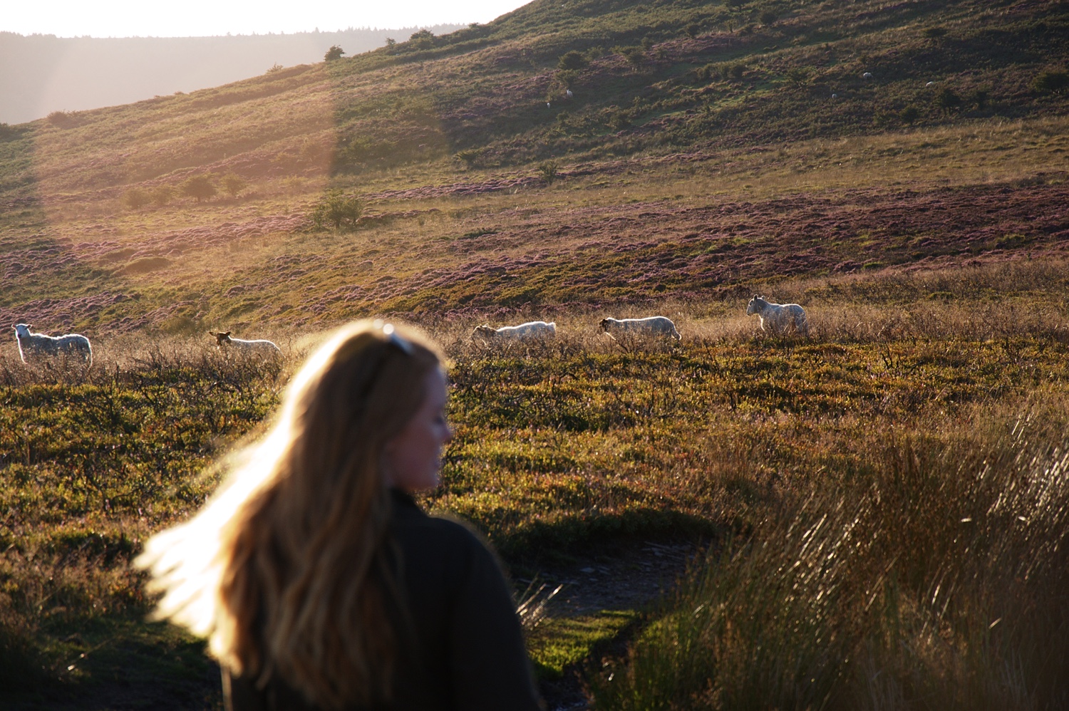
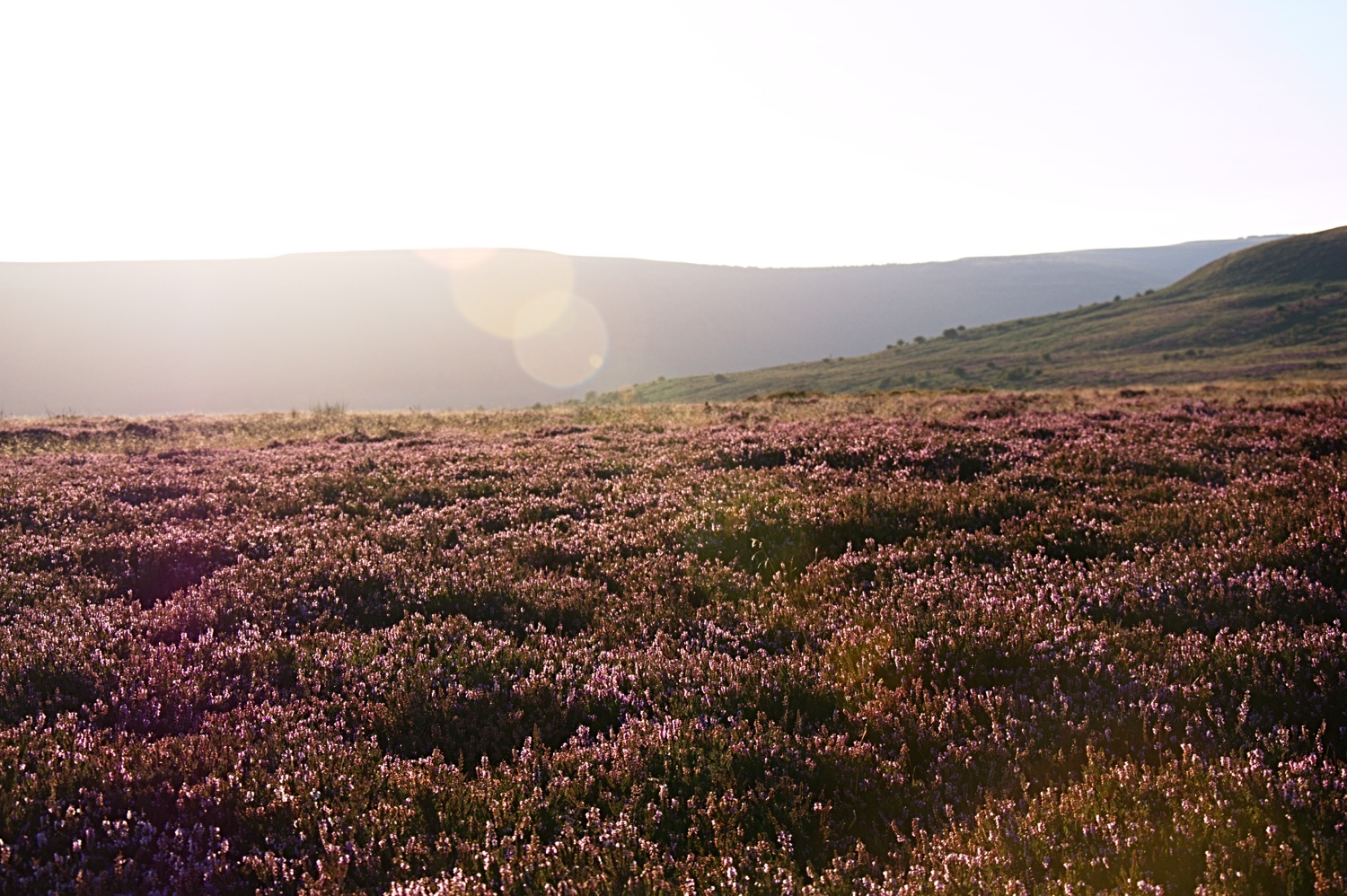
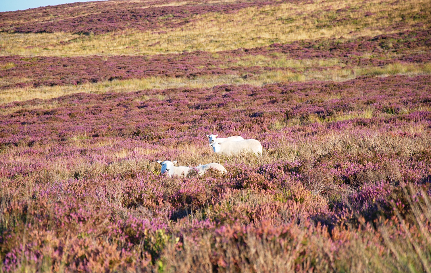
Last Sunday I decided to take a drive down to Llanthony, just on the East edge of the Brecon Beacons near Abergavenny. It is a great place to easily get to and to quickly get on the hills, as I set off in the evening light was short. I headed to Llanthony Priory a great place to start out as they have loads of parking, a place to eat and some will find the Priory remains interesting to see. This is a good place if you don't want to go all out on a long hike as most the routes in this area are fairly easy going. Correct me if I'm wrong but I think you can also go on a Pony trek from the Priory.
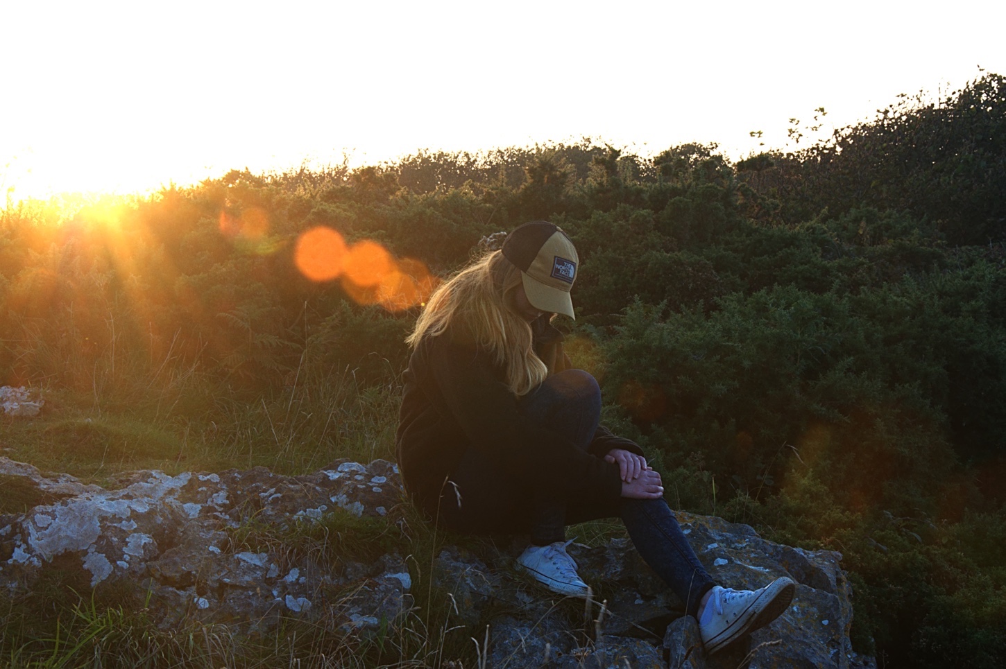
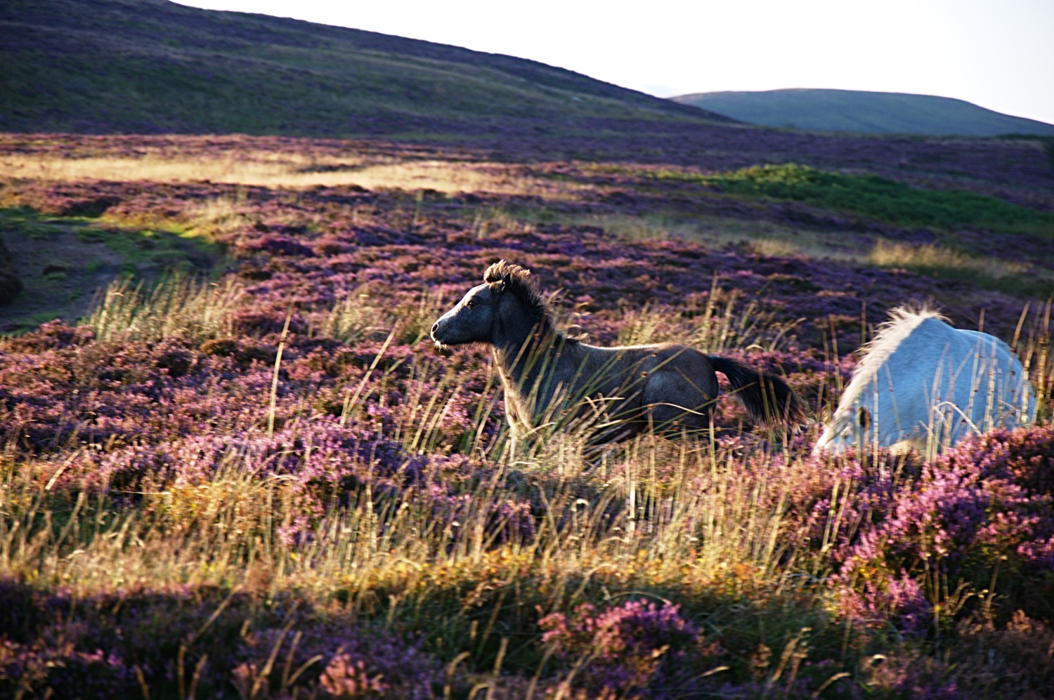
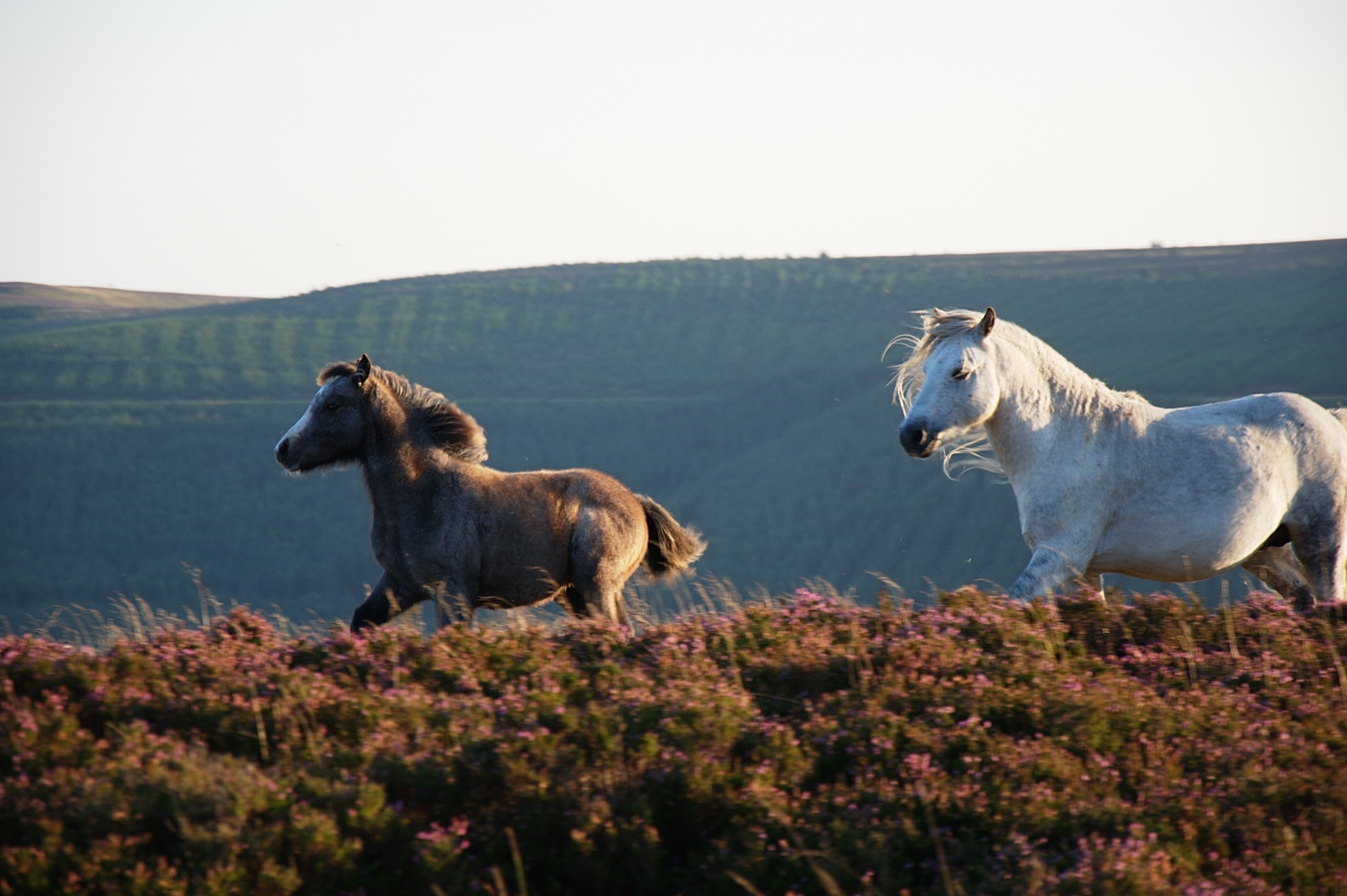
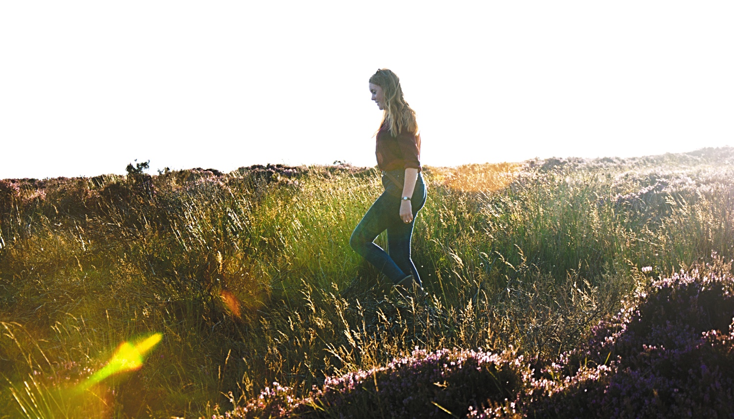
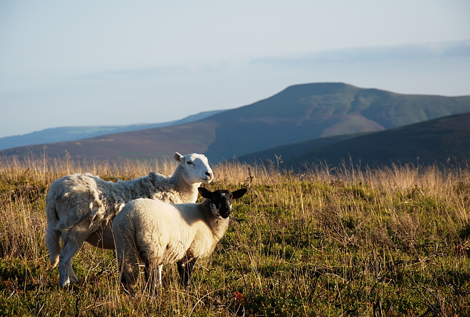
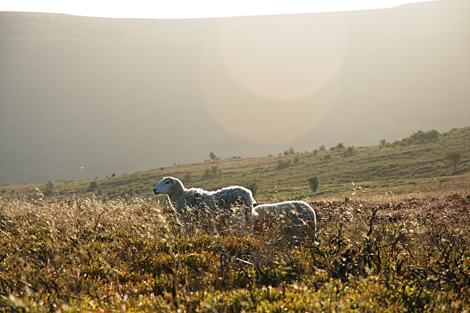
From the carpark we headed West into the Beacons, over the stream there are several paths to take up the ridge. We just guessed our way using the priory in the background as a reference, I don't think I even got the maps out the pack. The top of the ridges are wonderful at this time of year, the ground cover is purple and the ponies and sheep are all grazing happily, until they see us coming.
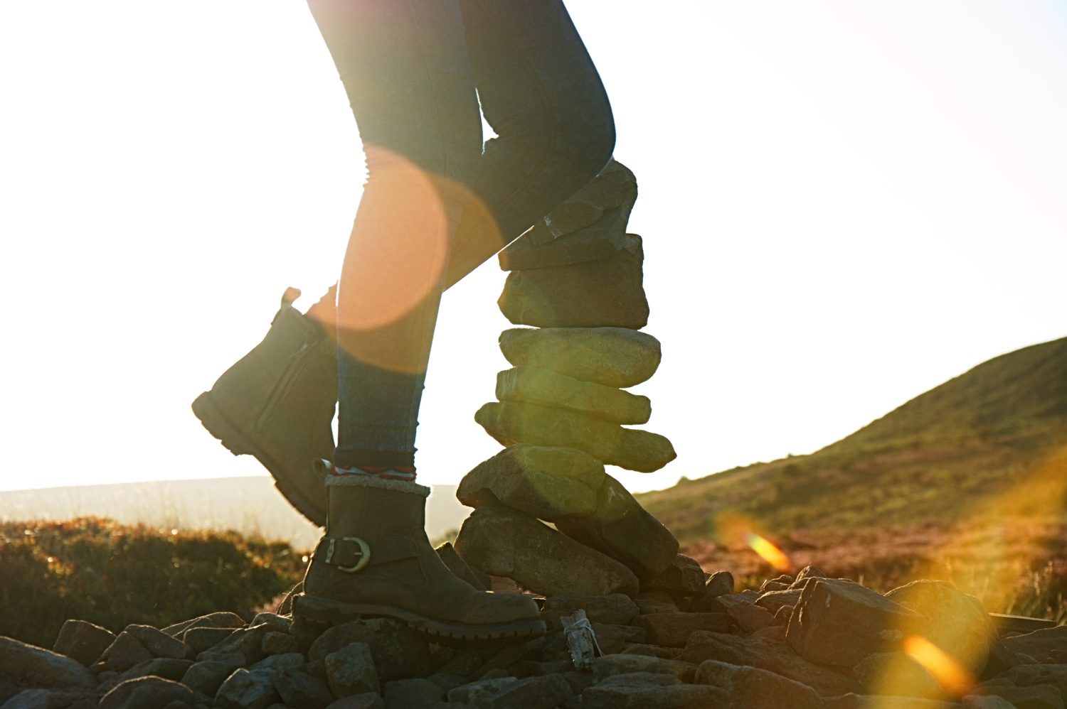
This is a small selection of the pictures taken. Enjoy.
If you would like to use any of the pictures in this article please contact [email protected].
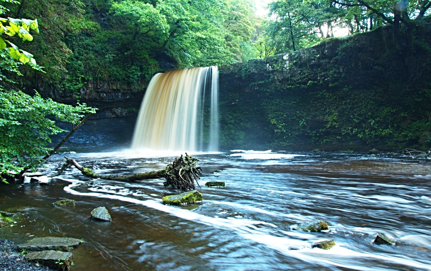
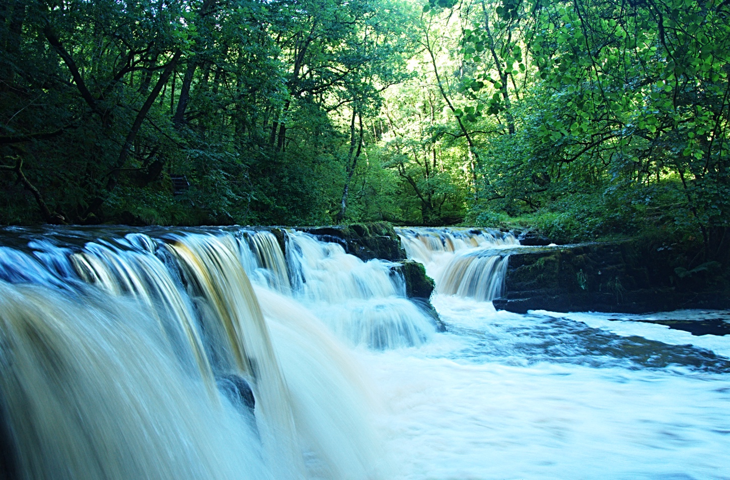
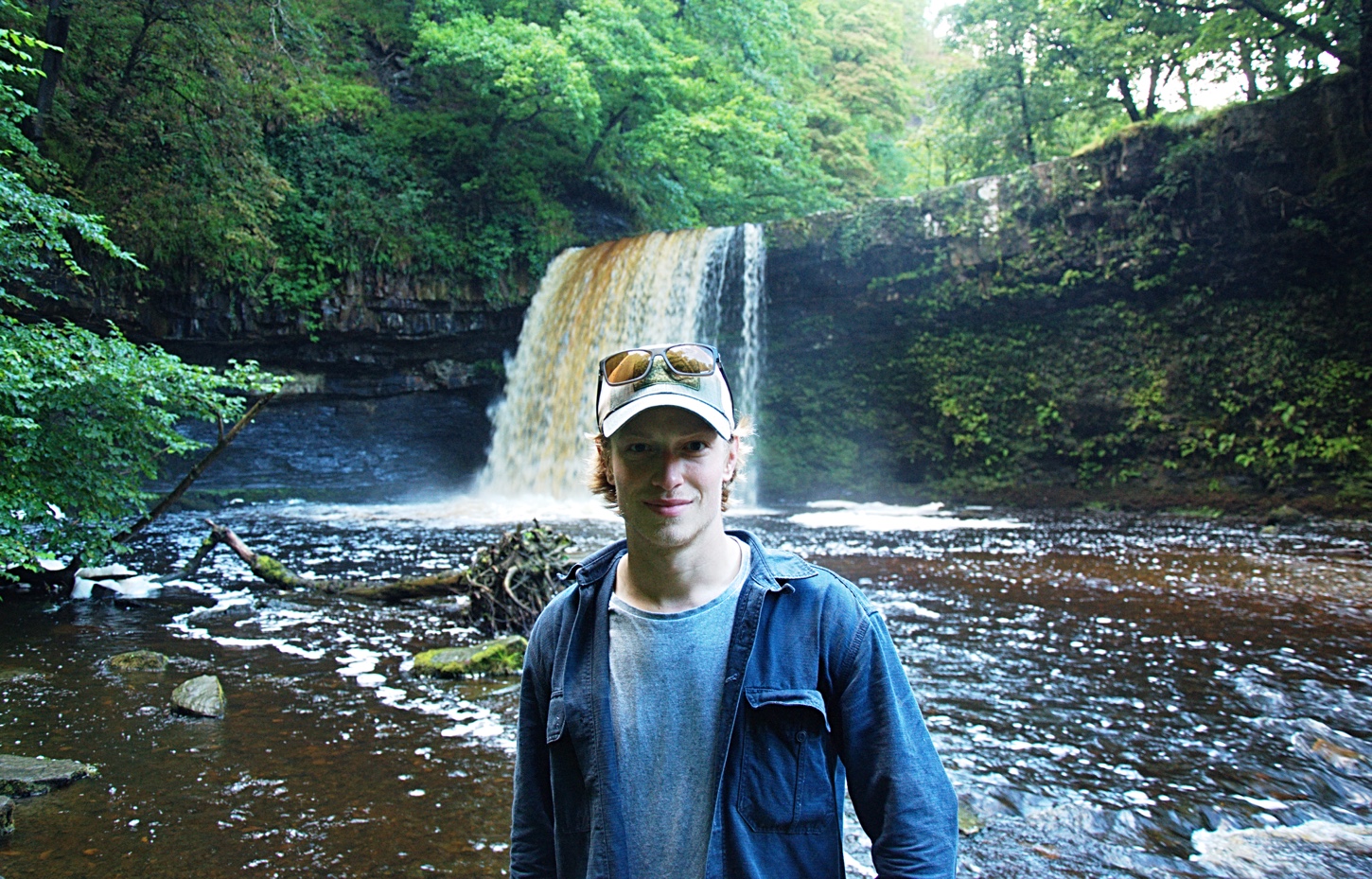
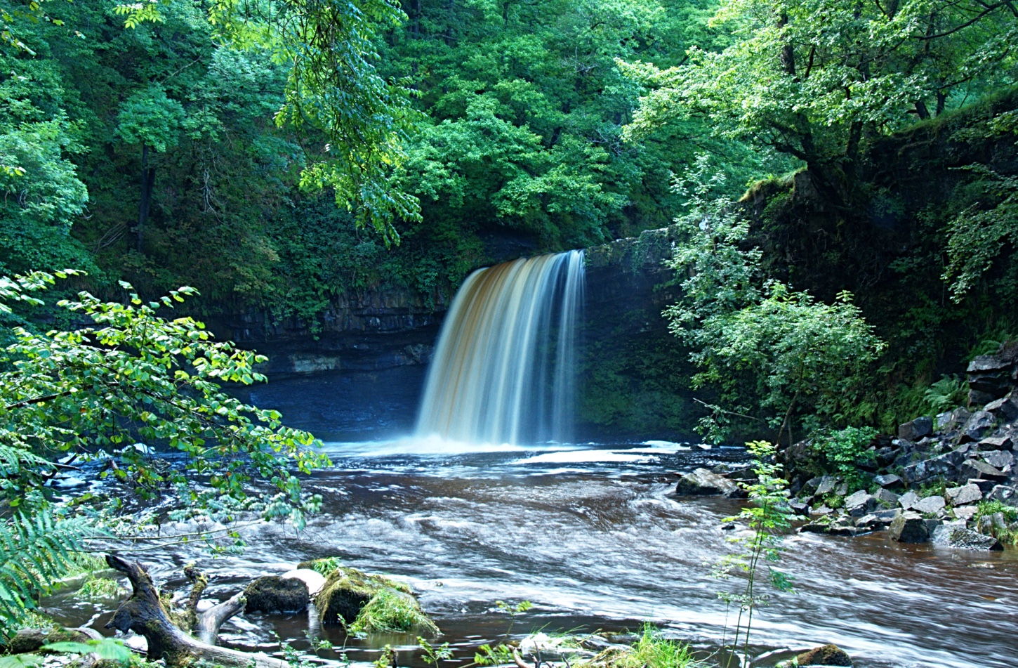
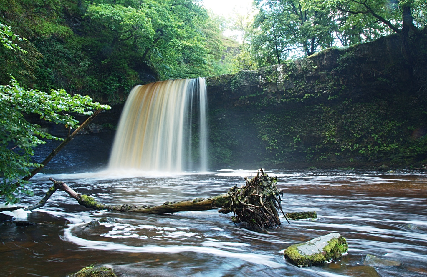
Waterfall Country - Brecon
Its strange to think summer is coming to an end, although August has felt like Autumn rather than Summer here in rainy England. With all the rain we've had I thought the Waterfall Country in the Brecon Beacons would be a fantastic sight and provide some good photo opportunities. How right I was.
I packed the photography gear and we set off towards the Brecon Beacons with my lovely girlfriend Sophie at the wheel of her Land Rover. All went well until she managed to get stuck in a ditch. Lucky, being in rural Wales we only had to wait 10 minutes until another Land Rover Defender drove past and offered to pull us out. I have to say what a friendly area, at least 15 cars stopped to check all was okay.


Eventually after driving through a ditch we made it to the Waterfall Centre at Pontneddfechan just West of Merthyr Tydfil, loads of parking and a few pubs to stop at for food and drink. You can walk straight from the carpark to the waterfalls within a few minutes, all super easy going.
I was surprised at how busy it was, being used to the other side of the Beacons I don't usually see so many tourists. Its nice to see so many people out and about but it really annoys me to see so much rubbish left of the paths.
Anyway below are a few pictures I took along the way, you can click on these to enlarge them.
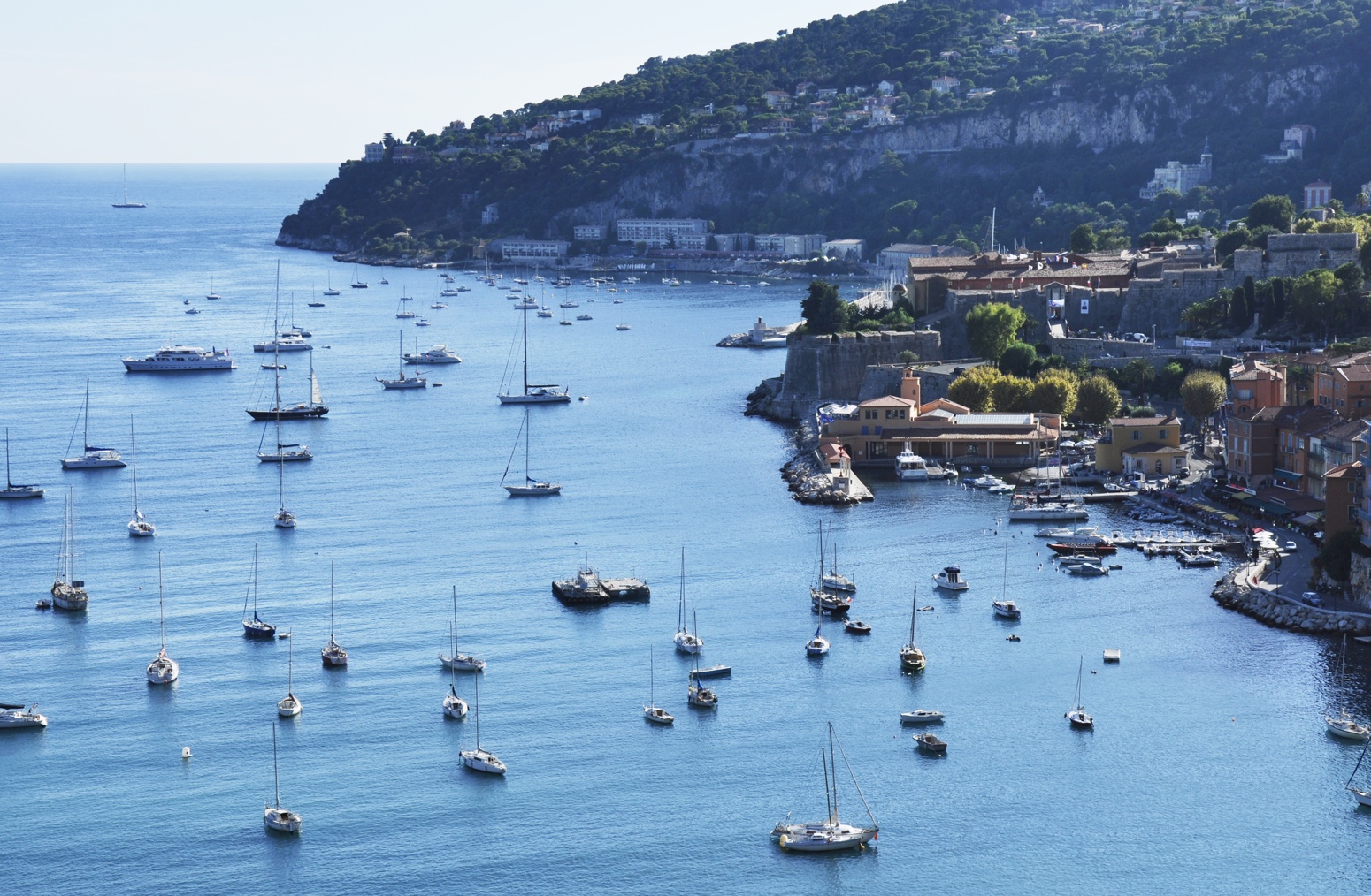
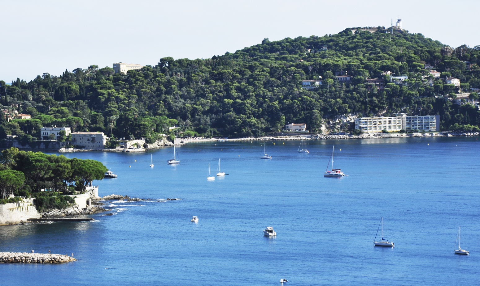
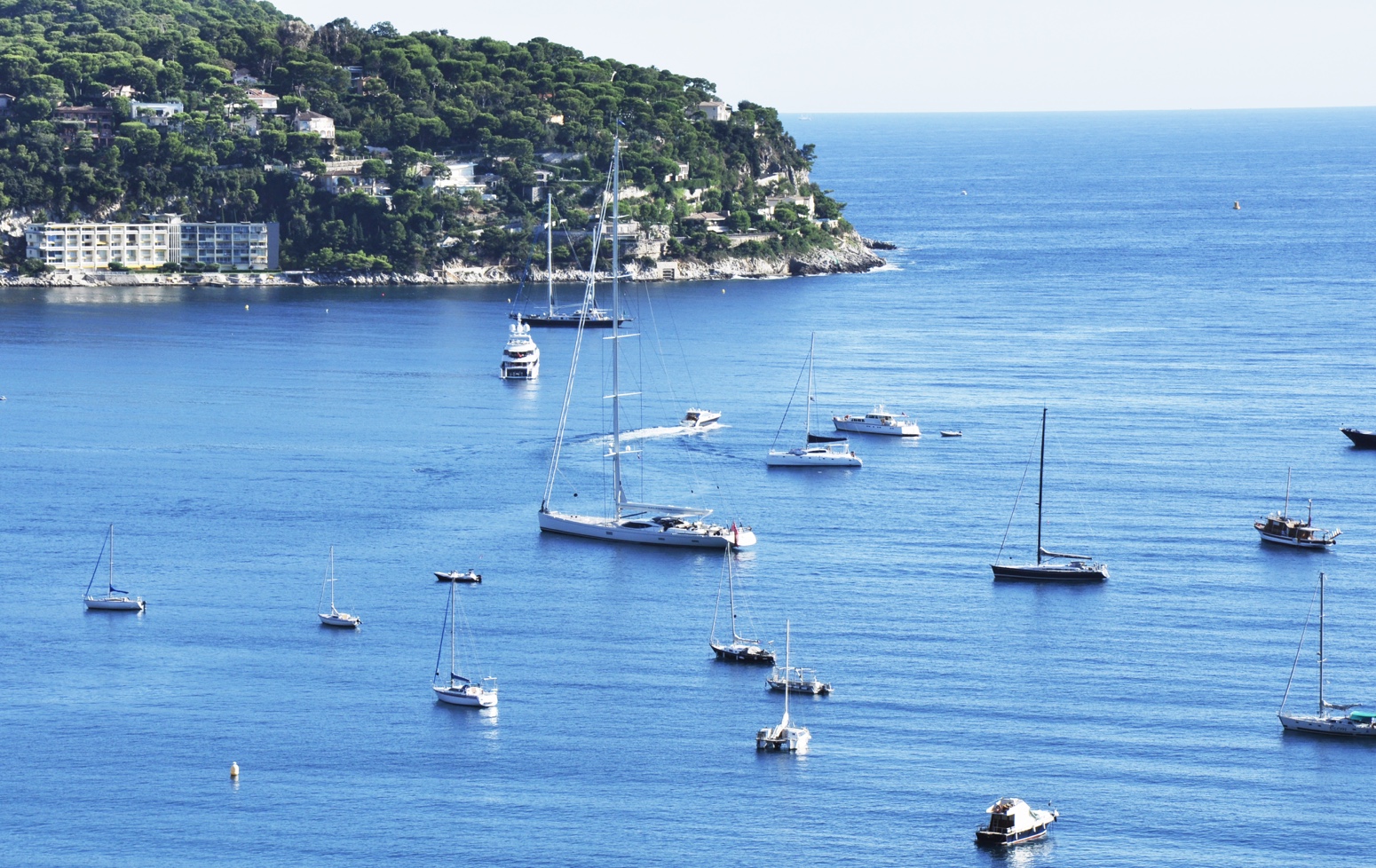
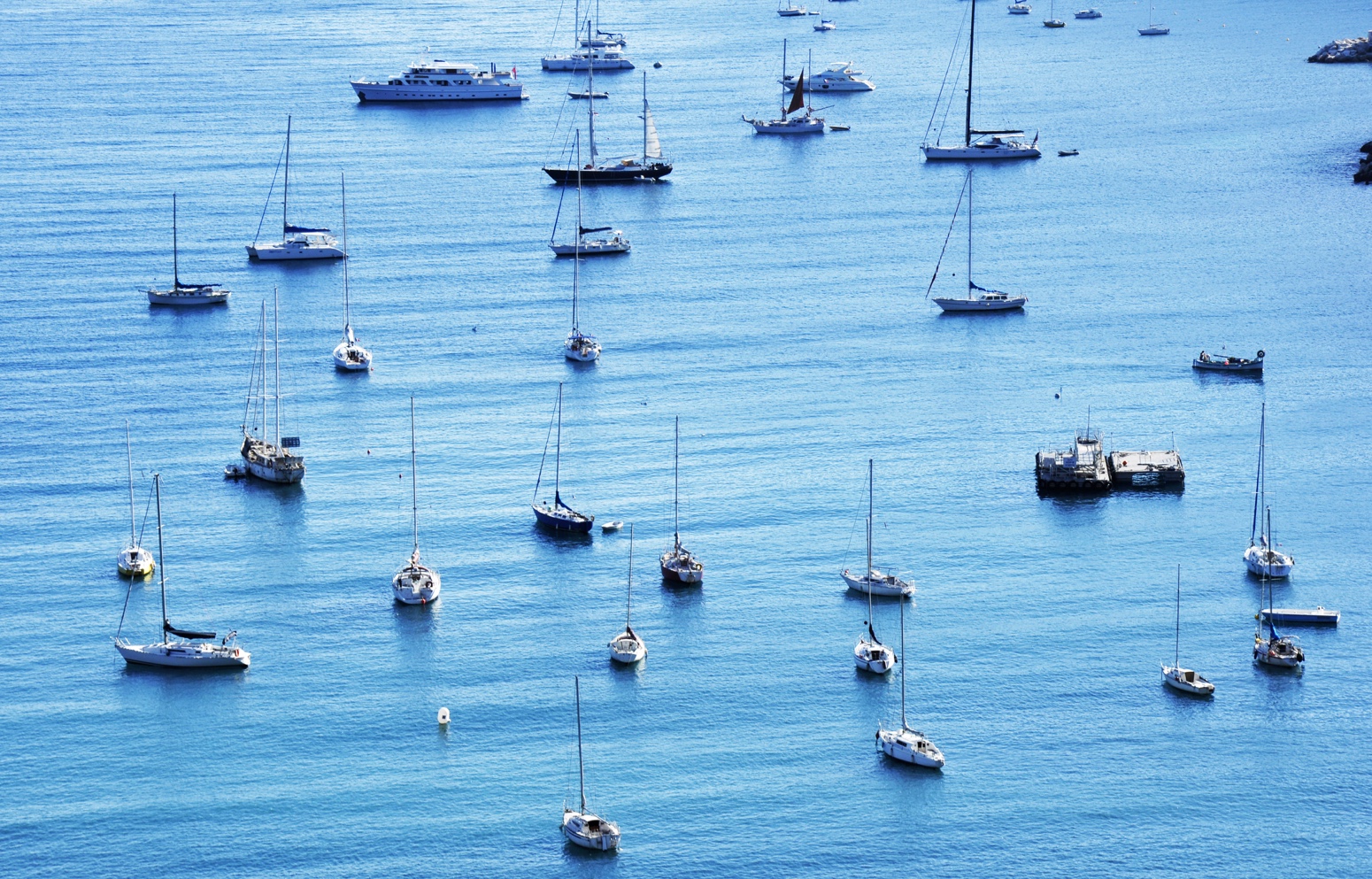
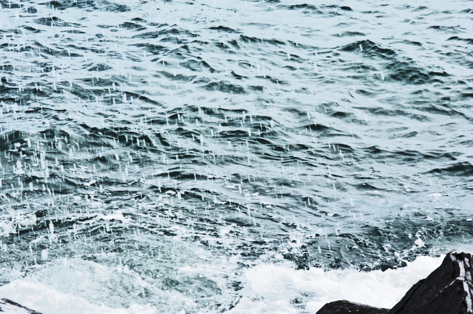
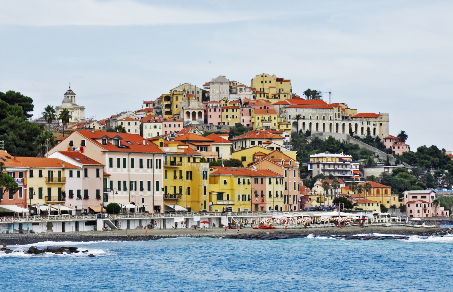
South of France - The French Riviera
In 2013 I went on a road trip around Europe, it was one of the best things I've ever decided to do. I set out with a a good friend and covered over 20 thousand miles of the best places to see in Europe.
These are a few pictures that I selected from my time driving along the French Riviera. We drove along the South coast of France from Spain passing through Andorra, we then went on to Italy.
One of the most stunning scenic drives that just gets better the closer you get to Italy, be sure to make plenty of stops as there is a tonne to see and photograph. Spend a few weeks at least, you can easily spend weeks in Marseille, Cannes and Nice but the drive between is spectacular.